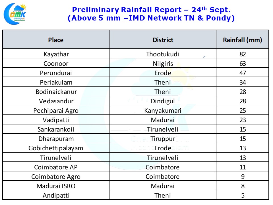
Thunderstorms returned back with a bang over Interior Tamil Nadu today with many places in West Interior TN and parts of South TN recording moderate to heavy spells of rains. Kayathar in Thoothukudi district recorded nearly 9 cms while Coonoor recorded 6 cms as of 5:30 AM today morning.
The thunderstorms that developed around Nilgiris / Northern parts of Coimbatore & Erode districts found their way to South Interior Karnataka during the night bringing heavy rains to some of the southern areas of Bengaluru as poor steering environment the thunderstorms just became stationary resulting in localized water logging in a few parts of the metropolis.
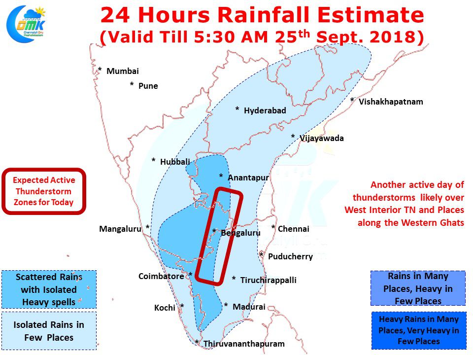
Today once again we are likely to see an active day of thunderstorms over Interior Tamil Nadu with wind instabilities continuing to persist on account of a weak pseudo circulation over the Gulf of Mannar region. This circulation also has brought some pseudo Easterlies over some of the coastal places like Chennai reducing the chance of thunderstorms reaching us.
The places along the Western Ghats once again is likely to see the better spells of thunderstorms compared to the rest of the state on account of the converging winds around these areas. While yesterday was a bumper day of thunderstorms for West Interior areas, today could also be a very good day of thunderstorms though we need to see the morning conditions to understand if a similar situation like yesterday could repeat.
On this day as we step into our 5th year of Weather Blogging we thank all our friends and well wishers for supporting us to the thick & thin.


