Yesterday saw many parts of Tamil Nadu record good thunderstorms in the districts of Erode, Tiruppur, Dindigul, Namakkal, Karur, Perambalur & Krishnagiri. As was the case on Sunday the steering winds were very slow yesterday too making the thunderstorms near stationary bringing good rains to those places which were lucky.
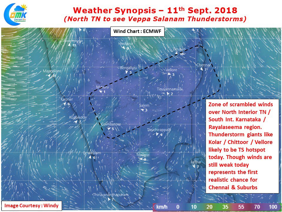
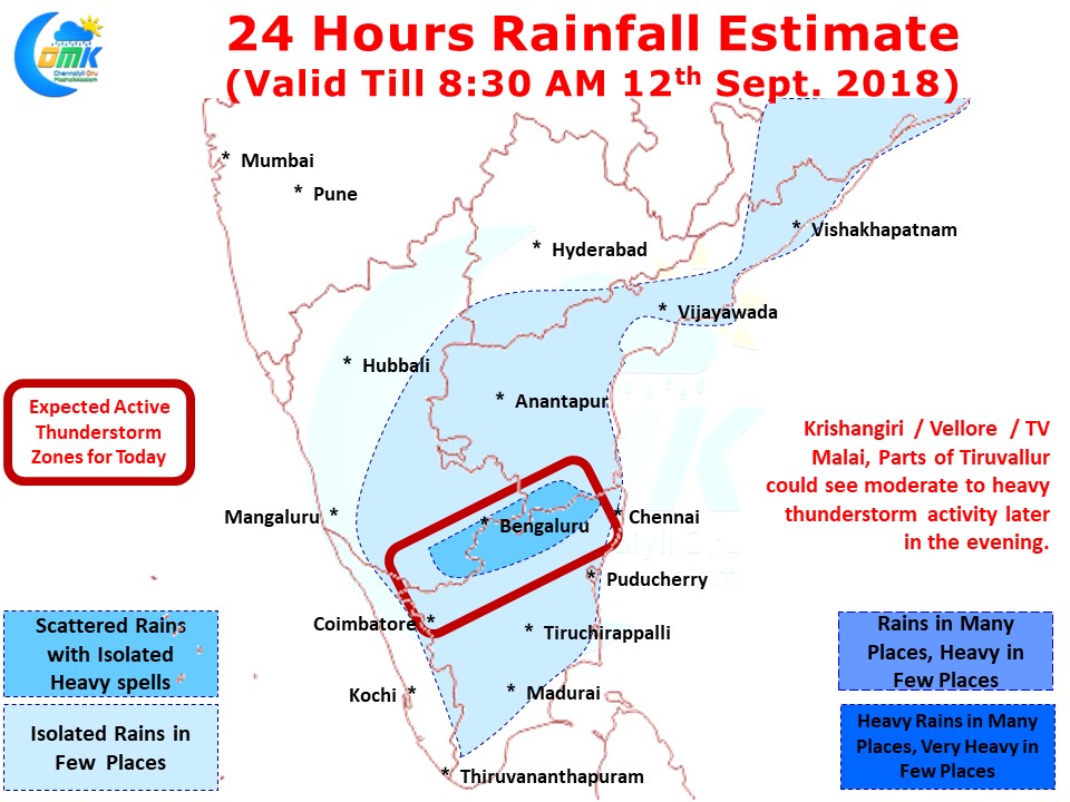
Today also conditions are ripe for thunderstorms to continue over many parts of the state with North Interior TN and adjoining parts of Rayalaseema & South Interior Karnataka. The zone of scrambled winds appears to be more pronounced around this region going by numerical models giving good probability for evening thunderstorms.
Today represents the first realistic chance for Chennai & Suburbs to witness thunderstorm activity. Though the steering winds continue to remain weak overall it appears to have strengthened slightly compared to the past couple of days giving a decent chance for some of the interior thunderstorms to reach the coast. With Models indicating the traditional Thunderstorm heavyweights like Kolar / Chittoor / Vellore could be the hot spot zone today, Chennai could benefit from some of these storms moving towards the coast. Fingers Crossed


