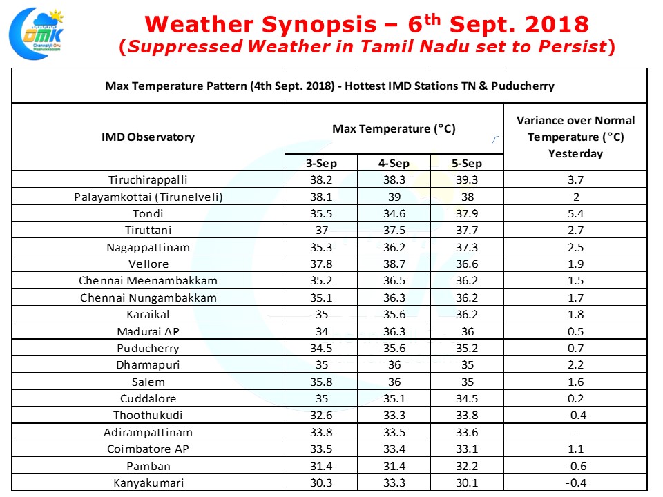
The Hot Weather in Tamil Nadu continues to persist with hot conditions prevailing over large parts of the state. Yesterday saw Tiruchirappalli AP nearly touch 40°C recording 39.3°C about 3.7°C above normal. Except for Ganganagar in Rajasthan which recorded 42.2°C Tiruchirappalli AP was the hottest among all the other major IMD observatories of India yesterday. On Tuesday Palayamkottai was the 2nd hottest place in India with once again only Ganganagar the hottest place.
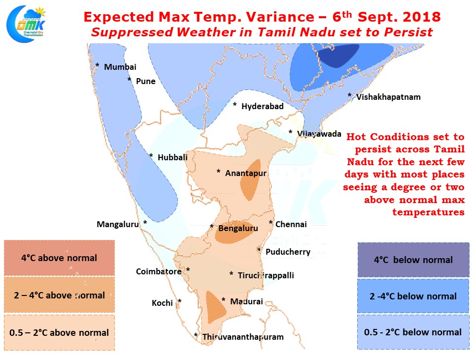
The movement of Sun from the Northern latitudes to the Southern latitudes during this time of the year means September typically sees a spike in temperatures. But on most occasions monsoon moisture acts as a shield to mitigate this to a certain extent, in the current context the suppressed monsoon conditions over the West Coast means the moisture shield is missing over Tamil Nadu amplifying the hot conditions during day time.
Today also afternoon max temperatures are set to be above average across Tamil Nadu with once again places like Tiruchirappalli, Tirunelveli, Tiruttani, Vellore likely to be hotter zones of the state. Chennai will possibly see temperatures in the region of mid to high 36s. All remaining days of this week is likely to see similar hot weather in Tamil Nadu continue with very little thunderstorm activity expected.
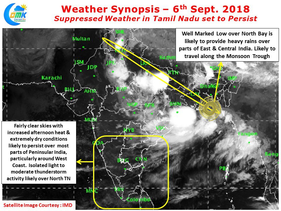
Under the influence of the current well marked low lying over North Bay area we could see some thunderstorms late evening around North TN but due to the overall suppressed state of atmosphere these thunderstorms will be extremely isolated and possibly moderate. So far the typical late August / September thunderstorms known for breaking window glasses at times is missing. Models indicate possibly sometime next week we could see an uptick in thunderstorm activity though it remains to be seen if this will turn into reality.


