With the first week of April winding down summer is still subdued over most parts of Tamil Nadu. If one were to look at the temperature anomaly charts for 2018 the areas around North Tamil Nadu have so far seen a degree or so below normal temperatures overall for the past month or so indicating the subdued summer conditions.
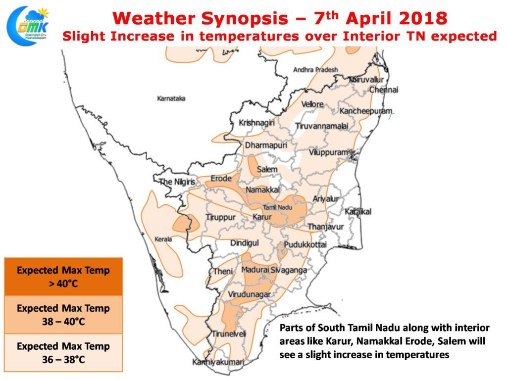
While South and West Interior Tamil Nadu have seen spurts in temperatures and occasional spikes as well the overall trend has been closer to normal for these areas as well. Yesterday saw no IMD observatory in the state record higher than 37.8°C which was recorded at Karur Paramathy with even places like Madurai AP recording sub 37°C. Today though there could be a slight increase in temperatures in West Interior Tamil Nadu & parts of South Tamil Nadu with a few places inching closer to 39 while North TN will continue to enjoy subdued summer conditions under partly cloudy skies at times.
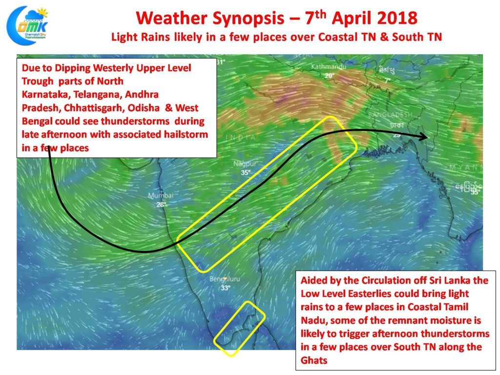
Under the influence of the Cyclonic Circulation off Sri Lanka & associated Easterly trough parts of South Tamil Nadu and coastal areas to the South of Puducherry could see light early morning rains in a few places over the next day or two. As the remnant moisture travels across the land during late afternoon on encountering the Western Ghats these could develop into possible thunderstorms to provide moderate spells of rains in one or two places of South Tamil Nadu along the Western Ghats possibly around Rajapalayam / Kalakkadu etc.


