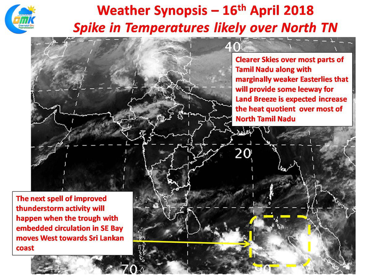
With thunderstorm activity over Tamil Nadu set for a slowdown as indicated in our post yesterday time has come now to get back to business on the Heat Front. So far Summer 2018 has been a disappointment on the heat front with mostly temperatures staying near normal or slightly below normal across Tamil Nadu.
The last week’s thunderstorm activity has certainly come as a welcome boost for most of the farming community in the state. While Chennai along with many parts of North Tamil Nadu may have missed the rains parts of Delta recorded some light to moderate rains in many places while South Tamil Nadu recorded good rains in many places. The overall rains in Tamil Nadu & Puducherry sub division for the Pre Monsoon Season starting from 1st March now stands at 44.4 mm with 26% surplus over the long period average.
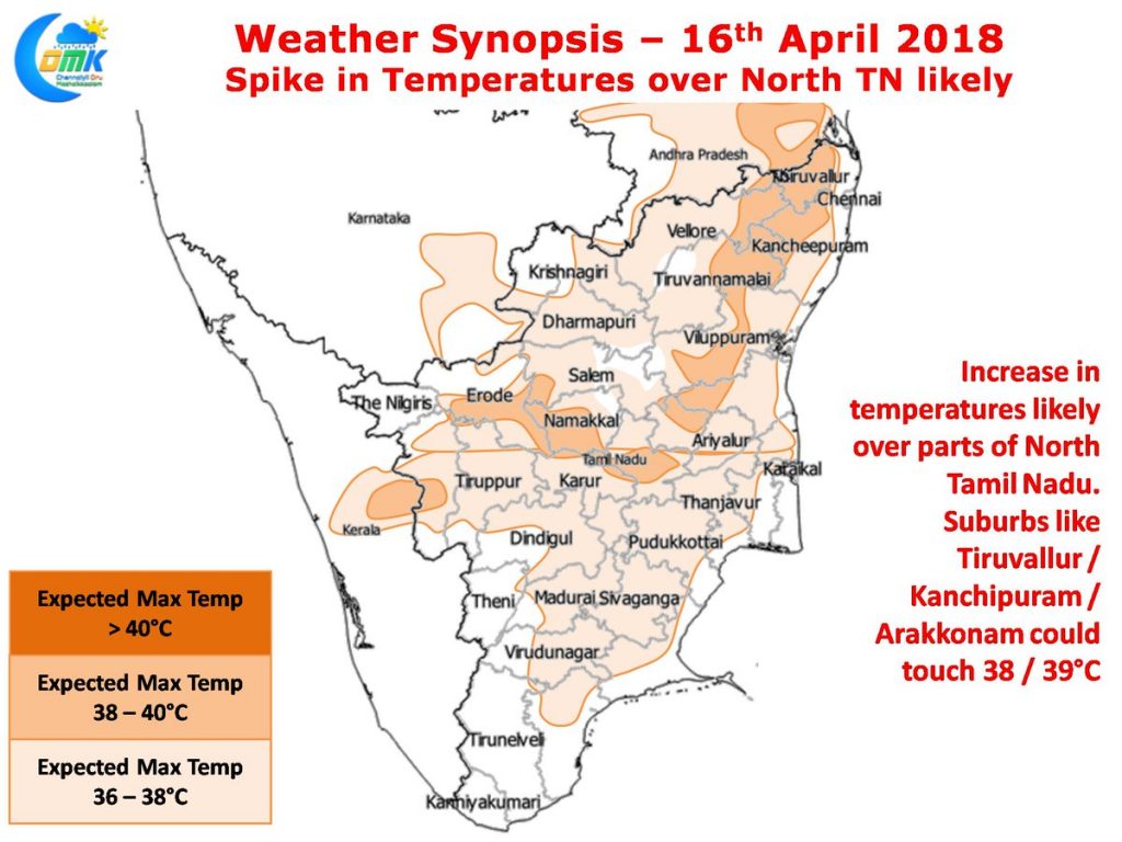
With no synoptic conditions in the immediate vicinity to influence weather conditions over the state the early morning satellite image indicates a clearer sky. The clearer skies in the morning along with the slight weakening of Easterlies as estimated by numerical weather models is likely to reflect on the temperature pattern over the state. In particular parts of North Tamil Nadu around Tiruvallur, Tiruvannamalai, Kanchipuram & parts of Villupuram district could see day time temperatures spike to around 38°C with some places even expected to nudge above 39°C. Some of the suburbs in the west like Tiruvallur, Arakkonam & Kanchipuram is likely to see fairly hot conditions while the city areas could see uncomfortable afternoon under the influence of weak sea breeze that will aggravate the humidity.


