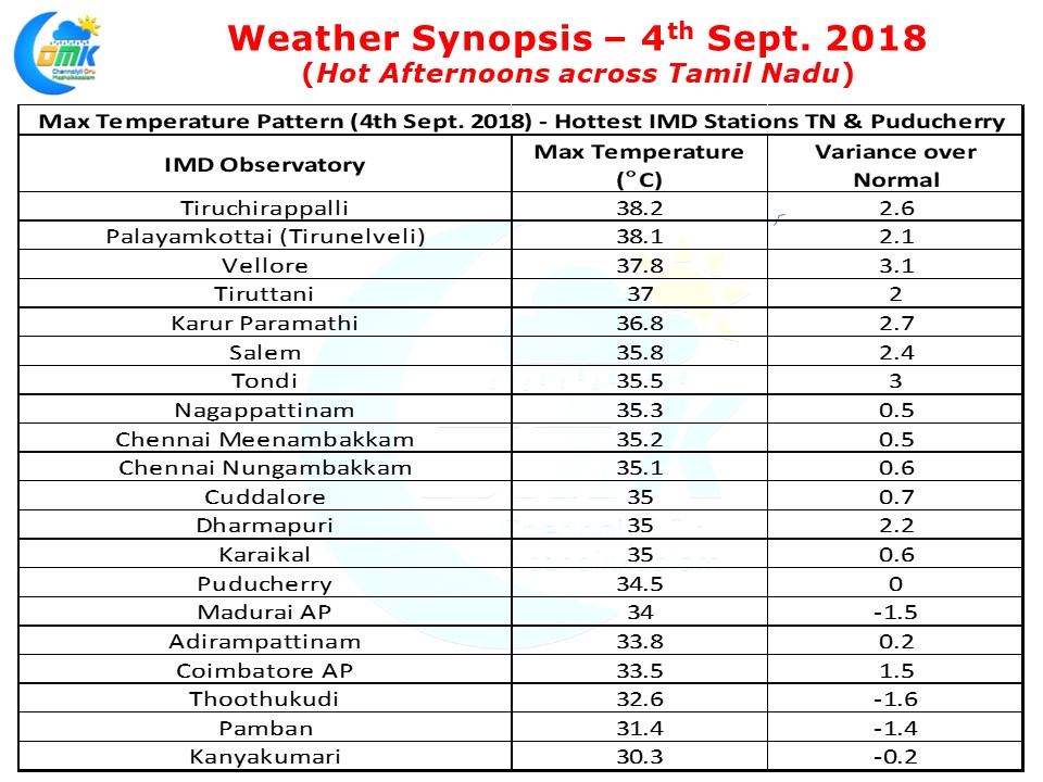
Yesterday saw most parts of Tamil Nadu record warmer than normal max temperatures under crystal clear skies. Vellore which is normally comfortable under active monsoon conditions saw a max temperature of 37.1°C more than 3 degrees above normal for this time of the year. Both the observatories in Chennai recorded marginally above normal max temperatures.
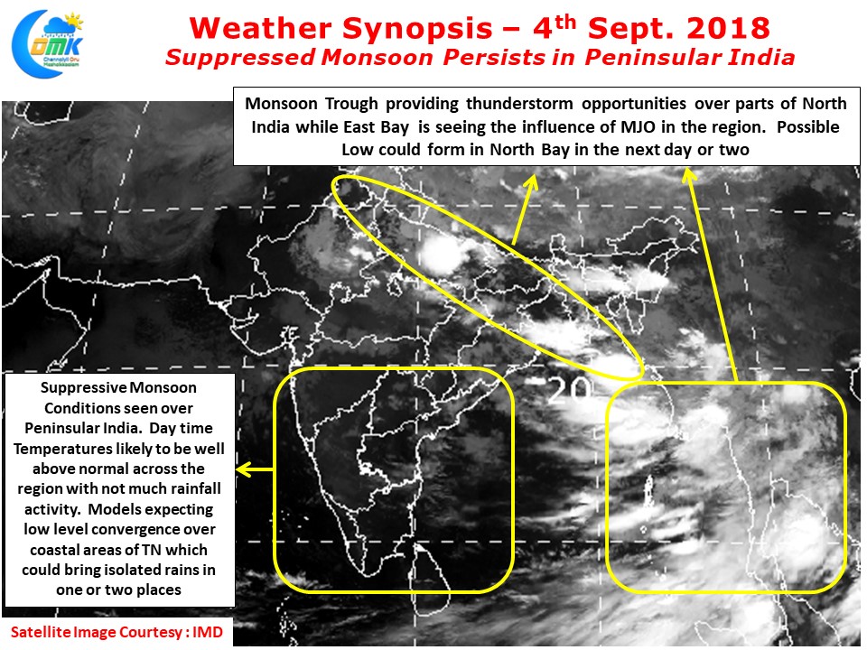
One of the key reason for this spike in temperatures is the suppressed monsoon conditions persisting over the West coast. As we have mentioned in the past under active monsoon conditions the moisture availability between 1.0 kms ASL & 3 kms ASL would act as a shield against radiation of heat keeping the temperatures under check.
But now the monsoon is extremely suppressed with very little clouding & moisture incursion happening from the Arabian Sea increasing the heat quotient all across. This poor moisture availability is also reducing chances of Veppa Salanam thunderstorms in Tamil Nadu despite strong instability triggered by wind patterns across coastal areas.
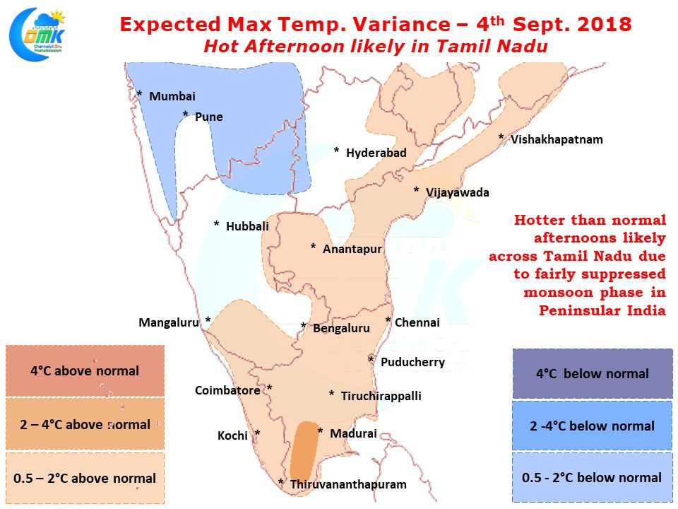
Models indicate today also temperatures to stay relatively higher than normal across Tamil Nadu with isolated pockets in South Tamil Nadu around Madurai / Virudhunugar / Tirunelveli / Thoothukudi districts likely to see max temperatures climb nearly 3 / 4 degrees above normal.
Places in South TN around Madurai / Ramanathapuram / Sivaganga dts are likely to see some isolated thunderstorms triggered by Low Level Convergence along with the coastal stretch between Delta & Chennai which could see short sharp spell of rains late afternoon as sea breeze front moves in a few places.


