Yesterday Kathiri started on a subdued note over Tamil Nadu with Tiruchirappalli & Tiruttani the only two places to have crossed 38°C while Karur Paramathi & Tondi of Ramanathapuram district recorded 37°C as partly cloudy skies and Easterly winds kept a check on temperatures across most parts of the state. Weather Models indicate another day of temperatures under check for most of Tamil Nadu.
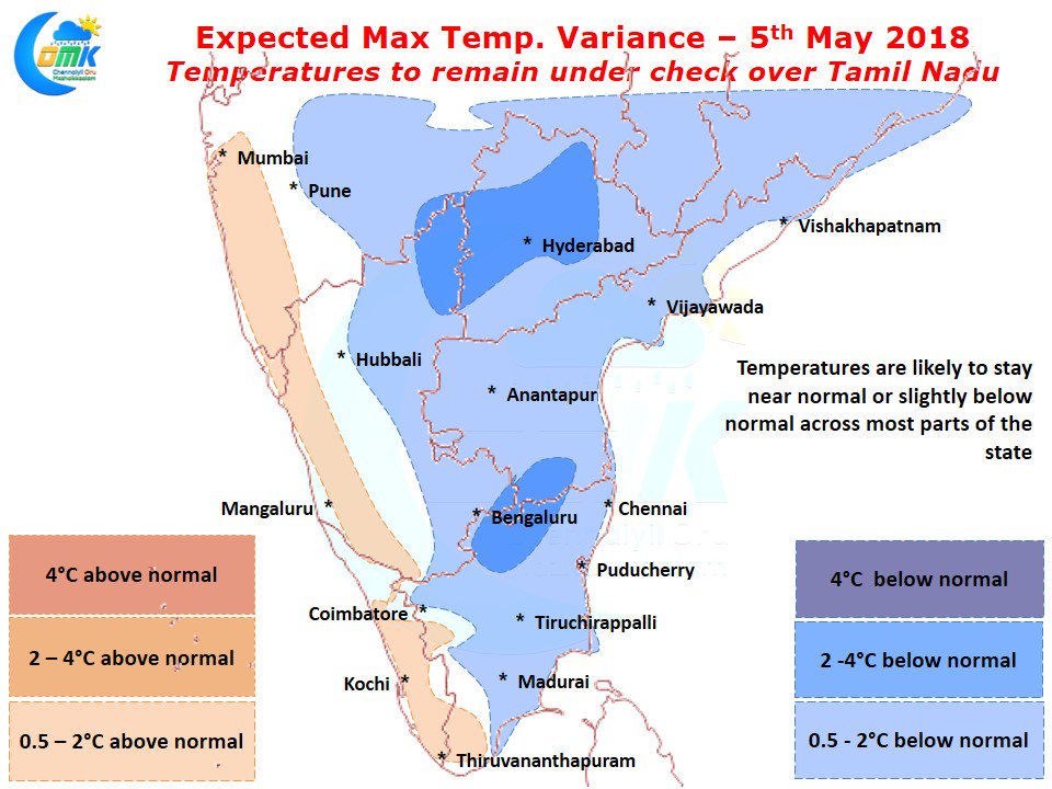
In particular parts of Northwest Tamil Nadu and adjoining parts of Rayalaseema & South Interior Karnataka could see day time maximum temperatures stay nearly 2 / 3 degrees below normal for this time of the year. One of the key reason for this subdued temperature pattern is the strengthening Easterlies.
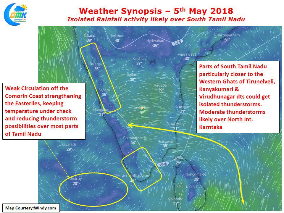
We all know at this time of the year the wind pattern gets ready for a change from the Easterly regime to the Westerly Regime. As we mentioned in our post yesterday the wheels of motion has been triggered for this with the arrival of Cross Equatorial Winds. But in the current context a weak Upper Air Cyclonic Circulation off the coast of Sri Lanka to the west has strengthened the Easterlies. This development is bound to impact both the temperature & rainfall pattern over the next couple of days.
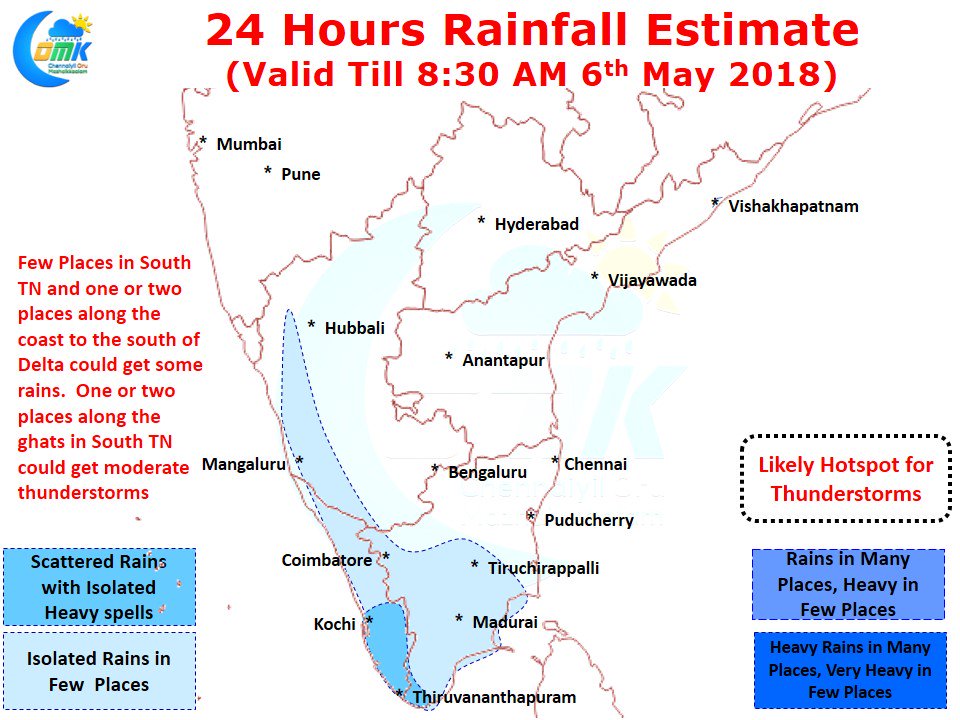
Unlike the last few days it will be the turn of South Tamil Nadu to enjoy a bit of rains over the next day or two. In particular we might possibly see one or two places along the ghats in the districts of Tirunelveli, Kanyakumari, Virudhunagar see moderate thunderstorms in the evening. Also the coastal areas to the south of delta areas could see a spell or two of rains in a few areas, while mostly these spells are likely to be light and short lived in isolated places it could be a sharp spell lasting for 10 / 15 minutes.


