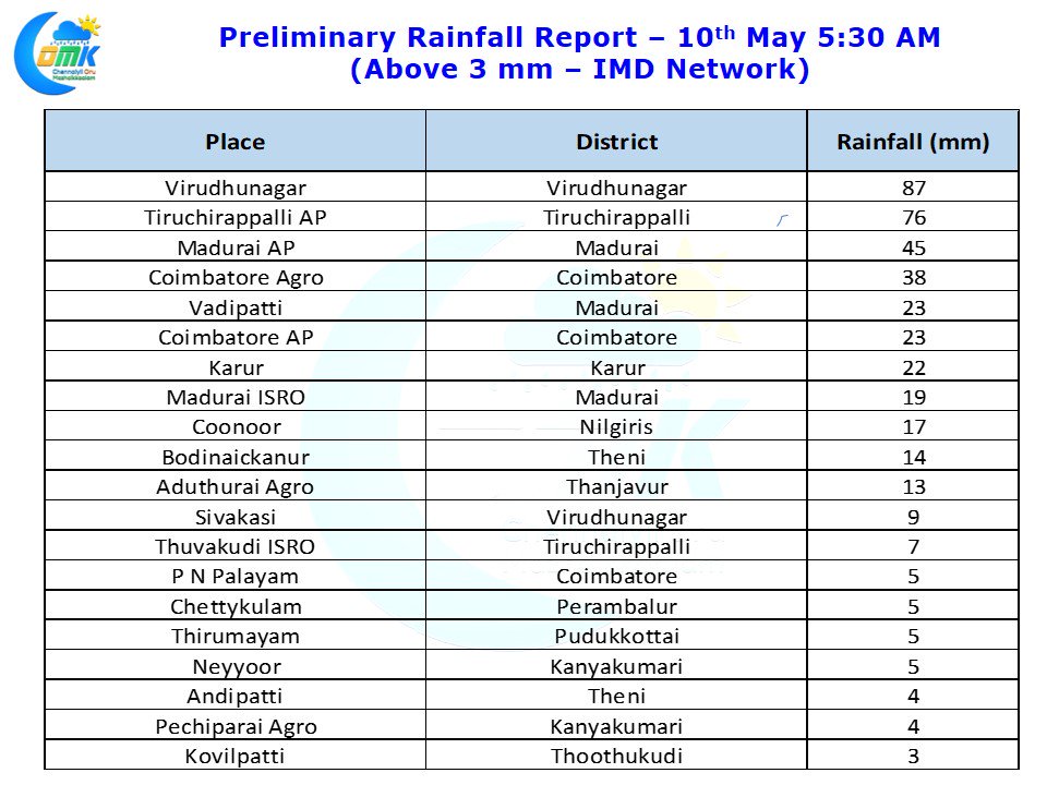
It was another extremely active day of thunderstorms for Interior Tamil Nadu with many places in the state recording good rains. In particular Tiruchirappalli recorded heavy spell of rains for more than an hour in the afternoon recording nearly 8 cms of rains bringing water logging into many low lying areas of the city. After missing out closely over the last few days yesterday stationary thunderstorms dumped the rains over most parts of the city though Thuvakudi which recorded 6 cms on Tuesday missed out mostly.
Similarly Madurai and Coimbatore also witnessed good thunderstorms later in the evening with the Airport observatory in Madurai nearly recording 5 cms of rains. Slightly to the south of Madurai, Virudhunagar, saw its thunderstorm saga continue with second straight day of good rains recording 87 mm adding to the 24 mm recording for 24 hours ending yesterday morning.
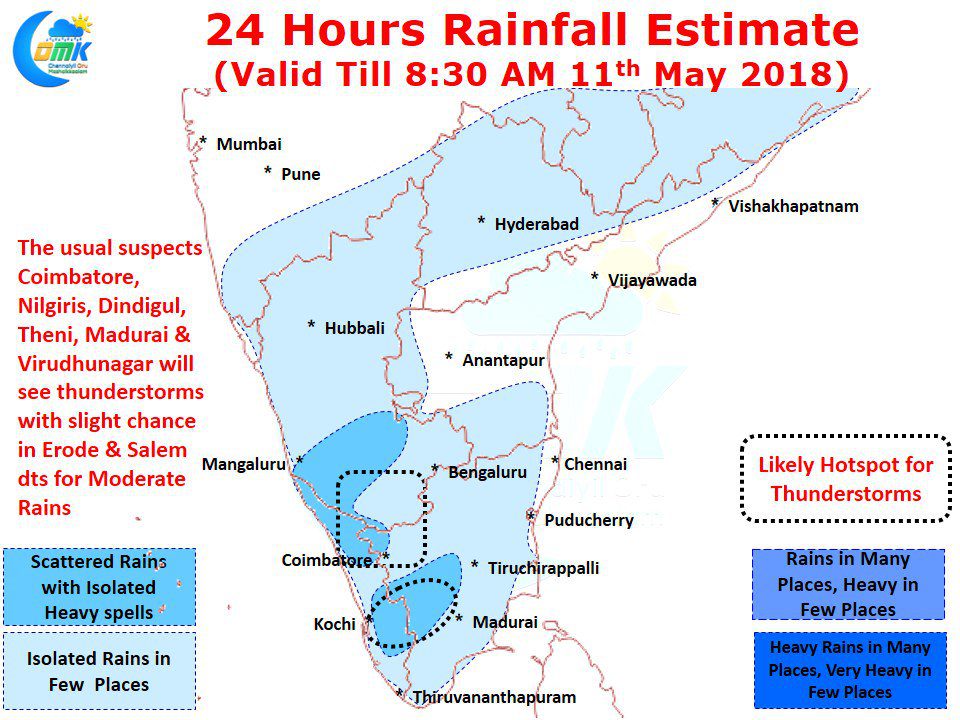
With wind discontinuity persisting over the interior parts of the state running from North Karnataka until South TN things look good for thunderstorms to continue over the interior parts of the state. In particular places along the Western Ghats starting from Nilgiris to Virudhunagar are perfectly placed for evening thunderstorms. South Interior Karnataka will continue to see moderate to heavy thunderstorms in a few places. Things pick up for Bangalore from today with possibly tomorrow representing a very good chance of evening thunderstorms for the city. Numerical Models indicate temperature to remain under control for most parts of the state with afternoon thunderstorms preventing spikes in temperatures over places like Madurai / Karur.


