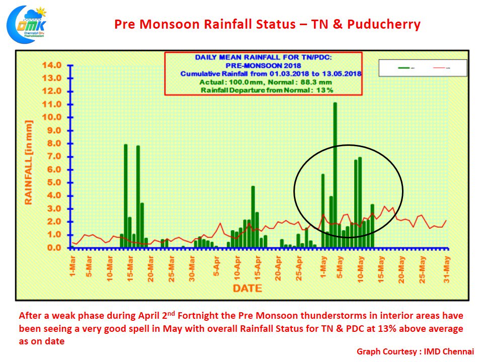
The interior areas of Tamil Nadu have been seeing active thunderstorms almost on a daily basis since the start of May. After what was a fairly poor second fortnight of April in terms of rainfall the Sub Divisional Rainfall Status of Tamil Nadu & Puducherry sub division now stands at 13% on the back of a very good performance in the first fortnight of May.
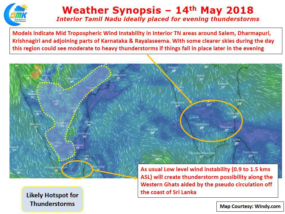
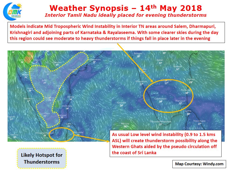
Today looks good for thunderstorms in the interior parts of Peninsular India with two different conditions likely to trigger the afternoon / evening thunderstorms. The usual phenomenon of Low Level Wind Instability ( 0.9 to 1.5 kms ASL) is likely to trigger thunderstorms along the Western Ghats partially aided by the perfectly placed pseudo circulation in the Comorin Sea Area of Sri Lanka. There is also a Mid Tropospheric Level Wind Instability in the Northwest Interior Parts of Tamil Nadu along with adjoining parts of Karnataka & Rayalaseema region.
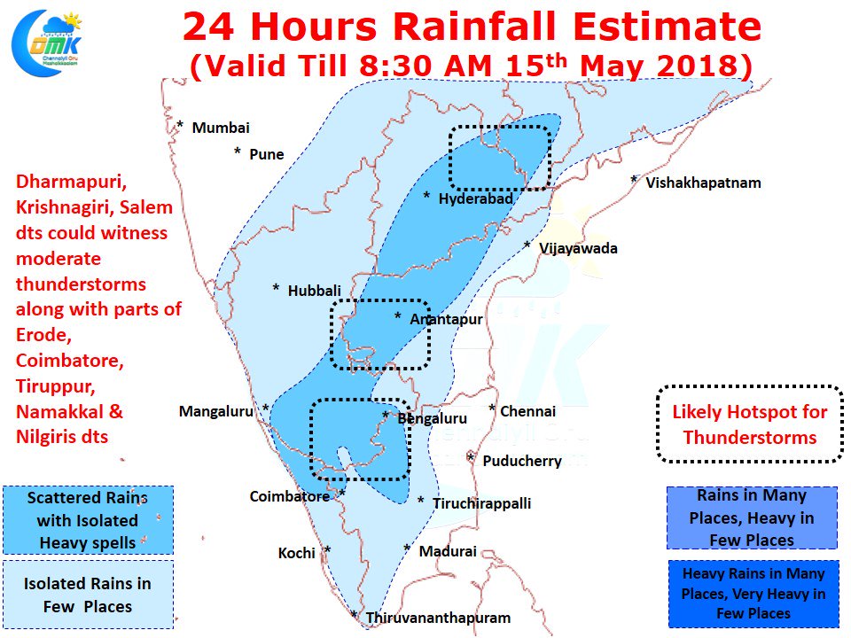
While most models do not indicate any major precipitation activity in this region, there is a firm possibility this instability at 4.2 kms ASL could trigger moderate to heavy thunderstorms in a few places. Places to the South & Southwest of Bengaluru like Salem, Dharmapuri, Krishnagiri could benefit from the evening thunderstorms if the Mid Tropospheric instability turns out to be a trigger.
The usual areas like Coimbatore, Nilgiris, Dindigul, and parts of North Erode & Tiruppur along the ghats could see thunderstorms. South TN could also benefit from low level Westerlies. On the temperature front for Chennai it is likely to be similar conditions like yesterday with possibly hotter conditions in the suburbs while city areas could benefit from the arrival of sea breeze around mid afternoon.


