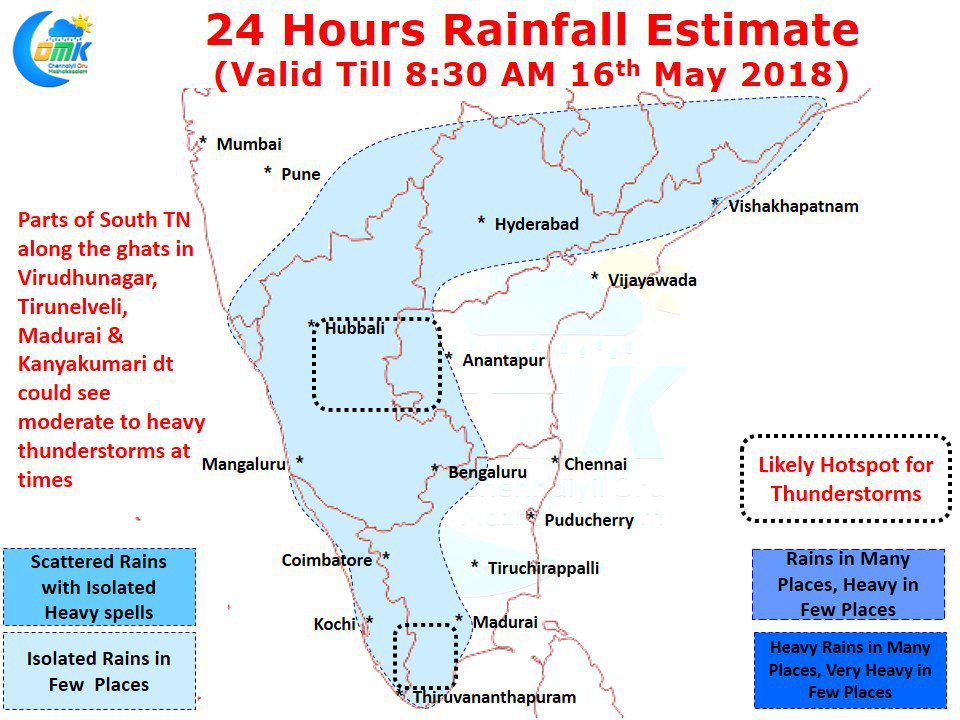
While the last few days have seen West Interior Tamil Nadu enjoy the best spells of thunderstorms South Tamil Nadu has also been seeing its fair share of rains with places like Sivaganga / Pudukottai dt recording moderate rains almost on a daily basis. A couple of days back many places in Kanyakumari district recorded good rains under the influence of strengthening Westerlies.
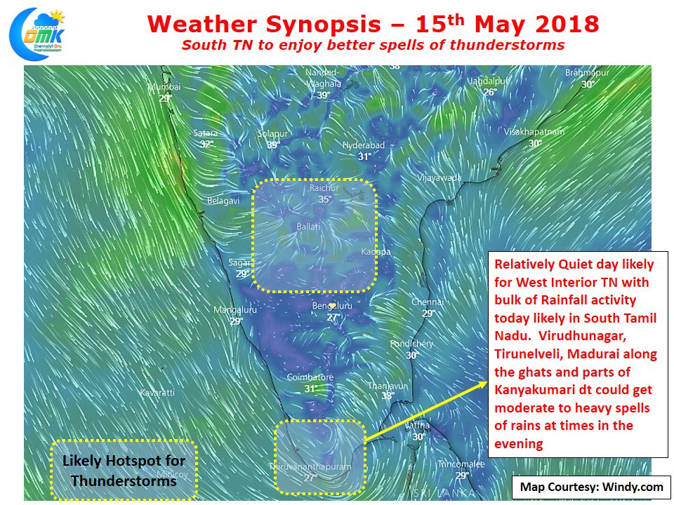
The wind pattern as indicated by model is slightly scrambled over West & Northwest Interior Tamil Nadu, this could influence the thunderstorm pattern with possibly a quieter day ahead for places like Coimbatore, Nilgiris district which has been seeing fairly intense thunderstorms on a daily basis. This would not mean these places could remain completely dry but the spatial spread of thunderstorms will be lesser than the last few days.
Models indicate possible convergence near South Tamil Nadu and the persisting pseudo circulation off the coast is likely to make it conducive for places like Madurai, Dindigul, Theni, Virudhunagar, Tirunelveli & Kanyakumari. In particular isolated places along the Western Ghats could see fairly heavy spells of rains due to the favorable angle of winds bringing in moisture. Temperatures will remain under control for Chennai with possibly some bit of high level clouding keeping the temperatures slightly below normal or near normal for this time of the year.


