This summer so far temperatures across Tamil Nadu has been near normal or slightly below normal in many places. Occasional spells of increased temperatures were seen when Easterlies weakened and the Westerlies strengthened. With the seasonal shift from Easterlies to Westerlies not picking pace yet the sub par summer has been continuing.
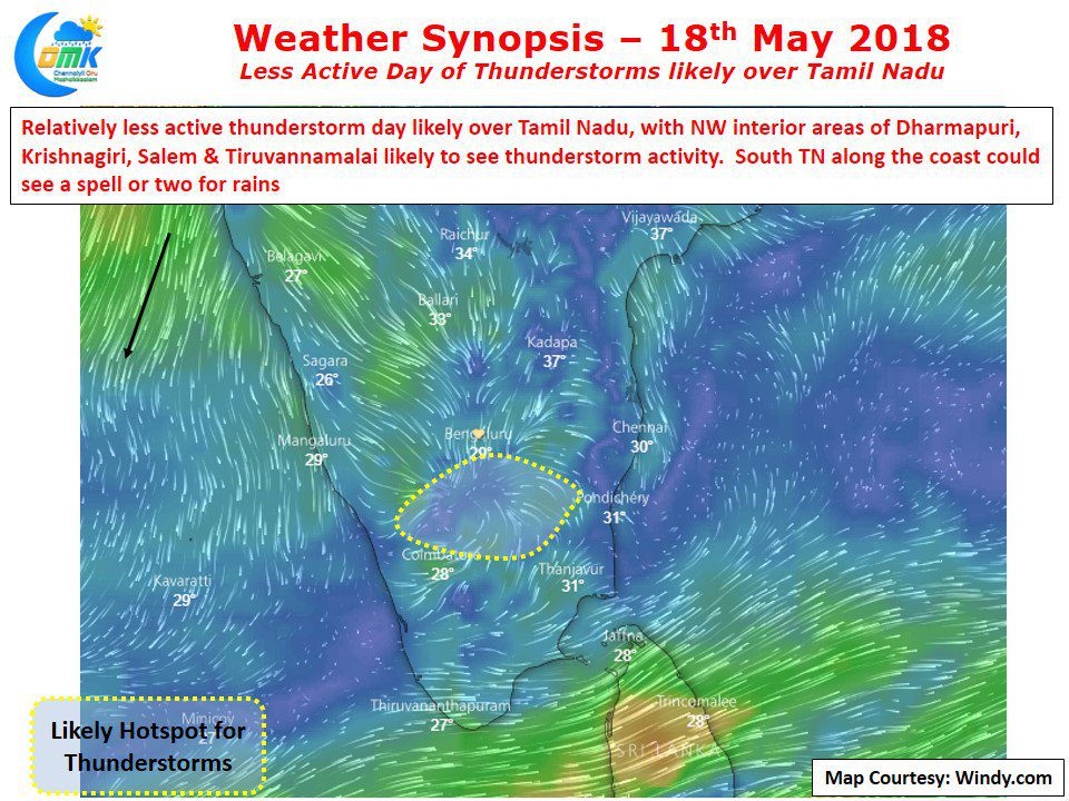
In the same context so far it has been an active pre monsoon thunderstorm season for the interior areas of Tamil Nadu and also many parts of Karnataka and Kerala. One of the key ingredient for these thunderstorms are the wind induced instabilities arising out of converging winds or at time scrambled winds. When conditions are more stable created by either streamlined Easterlies or Westerlies it has been a quiet day. Models indicate today to be one such day with lesser thunderstorm activity likely.
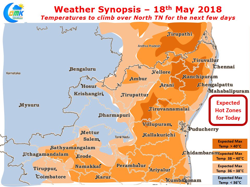
Wind charts indicate there is likely to be an area of convergence in Northwest Interior Tamil Nadu around Krishnagiri, Dharmapuri, Salem & Tiruvannamalai districts. Extreme South TN could continue to see Monsoon type a Westerly influenced rains along with parts of Kerala. Models indicate the next few days until possibly middle of next week temperatures will climb across most of North Tamil Nadu and in particular the interior areas of Tiruvallur, Kanchipuram, Vellore and Tiruvannamalai districts. Wind charts indicate a bit of strengthening of Westerlies inducing this temperature increase. With another disturbance likely to evolve over Arabian sea it remains to be seen if the Westerlies will strengthen permanently to bring a spike in temperatures and proper summer for places like Chennai.


