With just a day away from the normal touch down date for Monsoon in Indian Sub continent, thunderstorms are likely to peak over the next couple of days over the interior parts of Peninsular India before Monsoon dynamics slowly come into place. May 20th is the normal onset date for Southwest Monsoon in the southern parts of Andaman Islands effectively the first port of arrival in India though the much more famous Monsoon Onset over Kerala (MOK) happens about 10 days later.
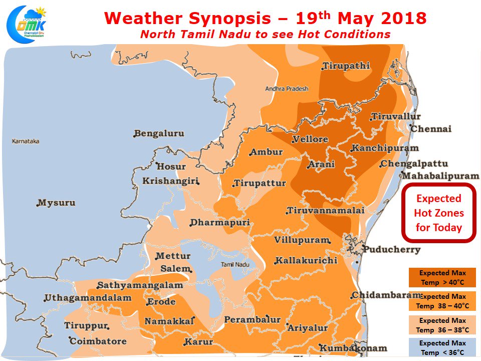
Models indicate an increase in temperatures over North Tamil Nadu with many places in the interior areas of the region expected to be around 40°C. A few places like Tiruttani is likely to see temperatures record around 41 / 42°C while the suburbs of Chennai could see max temperature around 38 / 39°C. Expect for a narrow band of about 5 – 10 kms from the coast most areas will be seeing temperatures in excess of 37°C.
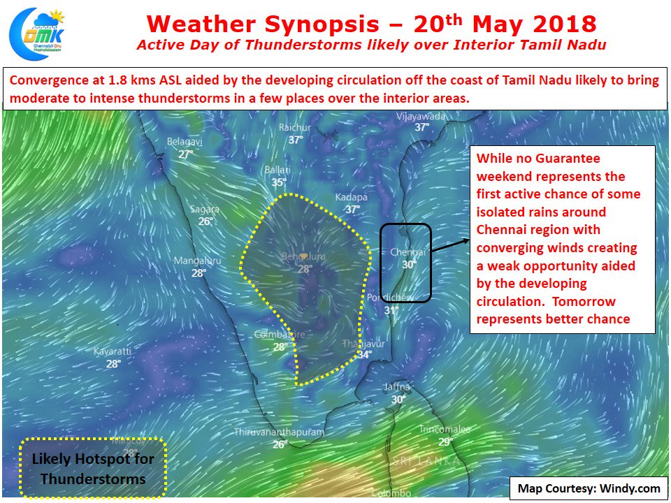
In a precursor to the monsoon dynamics a cyclonic circulation is developing off the coast of Tamil Nadu. Regular weather watchers will remember circulations on either side of Peninsular India is typically a monsoon onset indicator. This circulation is likely to initiate a convergence zone over the interior areas bringing in the possibility of moderate to intense evening thunderstorms.
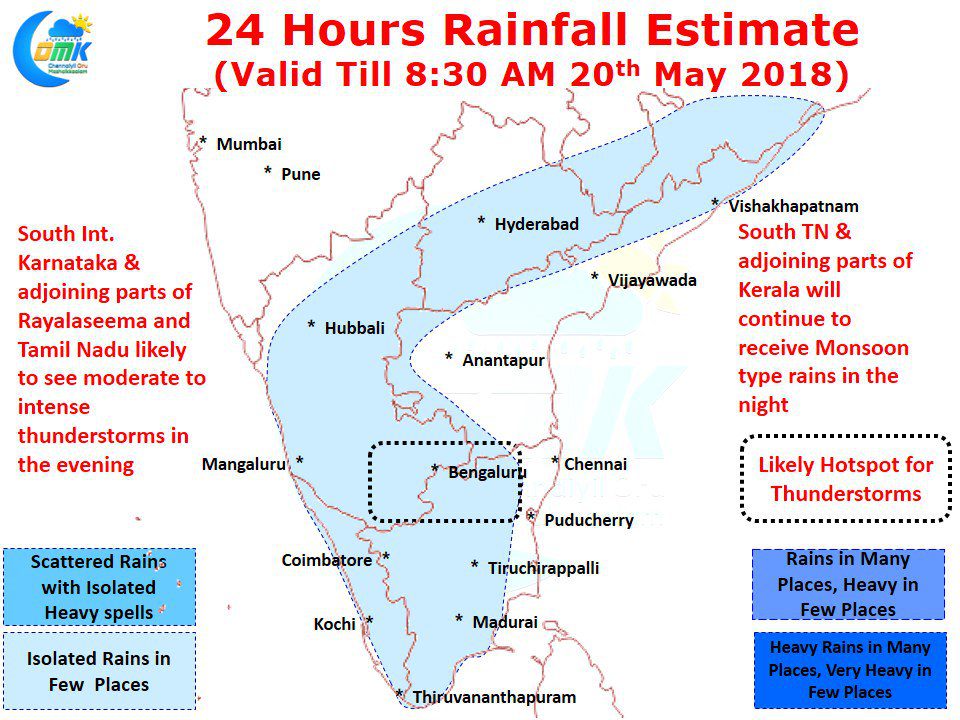
Parts of South Interior Karnataka along with the adjoining parts of Rayalaseema & Interior Tamil Nadu are ideally placed for these evening thunderstorms. Dharmapuri, Krishnagiri, parts of Vellore, Salem & Tiruvannamalai districts of Tamil Nadu could be the ideal hot spots for thunderstorms in the state. Extreme parts of South Tamil Nadu around Kanyakumari district will continue to get Monsoon type of rains under Westerly Influence. Kanyakumari has already got nearly 11 cms of rains in the past two days and tonight will represent another chance to add some more to the tally before Monsoon sets it. The circulation off the coast of Tamil Nadu is also bringing in a weak possibility of wind convergence around the Chennai region during the weekend. Though it is a weak possibility of rains nevertheless it is a possibility of rains with Sunday representing a better possibility compared to today. Will Chennai get anything out of it??


