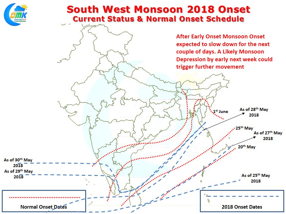
After an Early Onset the progress of Southwest Monsoon has slowed down with a couple of days break expected in the absence of any synoptic support for Monsoon to further climb up the latitude. The Well Marked Low off the coast a couple of days back played a crucial role in the monsoon climbing latitude up to Shirali in the West Coast. While the Well Marked Low helped the monsoon drag itself across most of Andaman Islands, due to its short life it was not able to pull the Monsoon currents over Northeast & East India rather ending up along the Arakan coast on 29th May.
The lopsided progress is nowhere more apparent than Tamil Nadu where the monsoon has reached only Thoothukudi latitude even though along the west coast it has crossed Chennai latitude. Weak Monsoon conditions give a different benefit to the interior areas of Peninsular India especially South Interior Karnataka, Rayalaseema & Northwest Interior Tamil Nadu. These areas typically do not see much rainfall during peak Monsoon conditions instead have to wait for weak monsoon conditions when lower wind speeds along with atmospheric instability create thunderstorm possibilities.
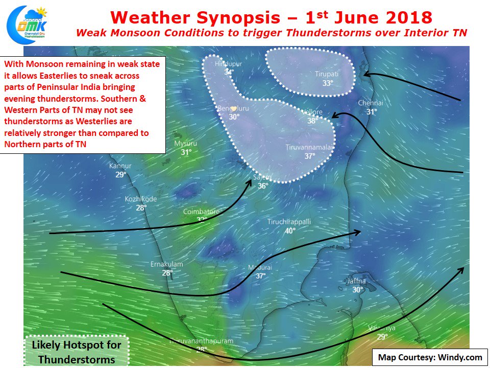
The prevailing weak monsoon conditions has allowed Easterlies to penetrate up to the interior areas over parts of Peninsular India creating atmospheric instability. While South & West Interior Tamil Nadu are seeing monsoon winds bringing Westerlies over these region minimizing thunderstorm possibilities Northwest Interior Tamil Nadu still is under Easterly influencing creating possibilities of evening thunderstorms. Over the next couple of days we will be able to see thunderstorms get closer and closer to Chennai and adjoining parts of North Tamil Nadu.
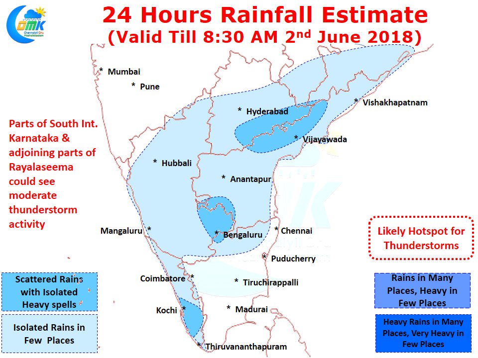
Today we could see thunderstorm activity in parts of Tiruvannamalai, Vellore, Krishnagiri districts along with possibly parts of Tiruvallur & Kanchipuram dts. Temperatures are likely to remain hot over most of North Tamil Nadu with many places expected to see max temperatures in the region of 38 / 39°C.


