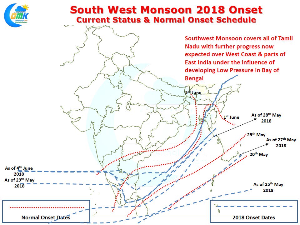
As Southwest Monsoon completes its onset over the entire state of Tamil Nadu the entire weather blogging community in India is now looking forward to what could be a monstrous onset over the Konkan region. Since May 30th Southwest Monsoon has been stationary over the West coast with slow progress on the East Coast. On 29th May it first checked in over Tamil Nadu covering up to Thoothukudi. Subsequently it was stationary for a couple of days until yesterday when IMD confirmed Monsoon has covered all of Tamil Nadu touching the shores of Andhra Pradesh for the first time.
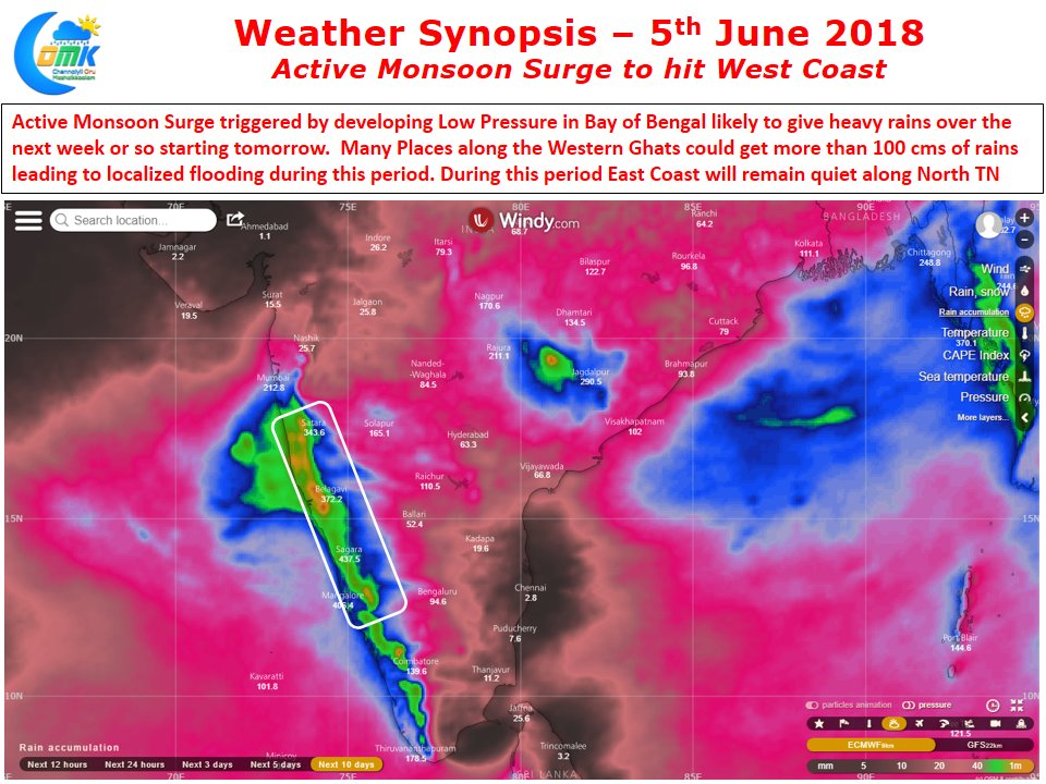
After a lull in the monsoon dynamics for a few days it is expected to get onto Overdrive just as it is expected to climb up the latitude towards the Commercial Capital Of India, the Megapolis of Mumbai, with stage set for the usual suspects along the Western Ghats to get extreme precipitation events over the next week to 10 days time. We have mentioned this often, Southwest Monsoon is a Low Latitude Monsoon dynamics with strong skew towards lower level winds between 0.9 and 1.5 kms ASL. When the moist winds from the Arabian Sea get trapped by the lofty Western Ghats unable to climb any further they dump loads of rains over the windward side of the Ghats.
Right from Shahyadris up to the Agasthiyarkoodam hills all along the Western Ghats you have places that see seasonal rainfall totals that is among some of the highest in the World. Not only places like Agumbe, Amboli, Valparai, Neriyamangalam, Mahableshwar that dot the high ranges of Western Ghats are among those places seeing heavy rainfall during Western Ghats, the narrow coastal strip along the Konkan also see very heavy rainfall.
Models indicate a very active monsoon surge brought out by a Low Pressure Area in Head Bay over the next couple of days. This is likely to create a strong moisture drag across Peninsular India bringing a huge uplift for the monsoon dynamics. Additionally it always is a case when there is a LPA / Monsoon Depression in the Head Bay area there is a counter off shore trough along the West Coast making it conducive for high rainfall events. When the West Coast is active the east coast sees a suppressed phase of thunderstorm activity. The key reason for this is the increase in Westerly wind speeds preventing the formation of thunderstorms. If one were to look at the wind charts in the coming days, the speeds are nearing 60 / 70 kmph at 850 & 700 hPa levels making it impossible for any development of thunderstorms.


