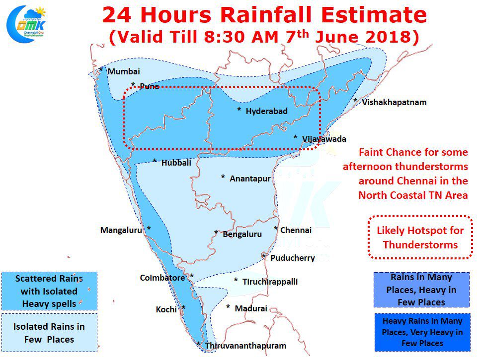
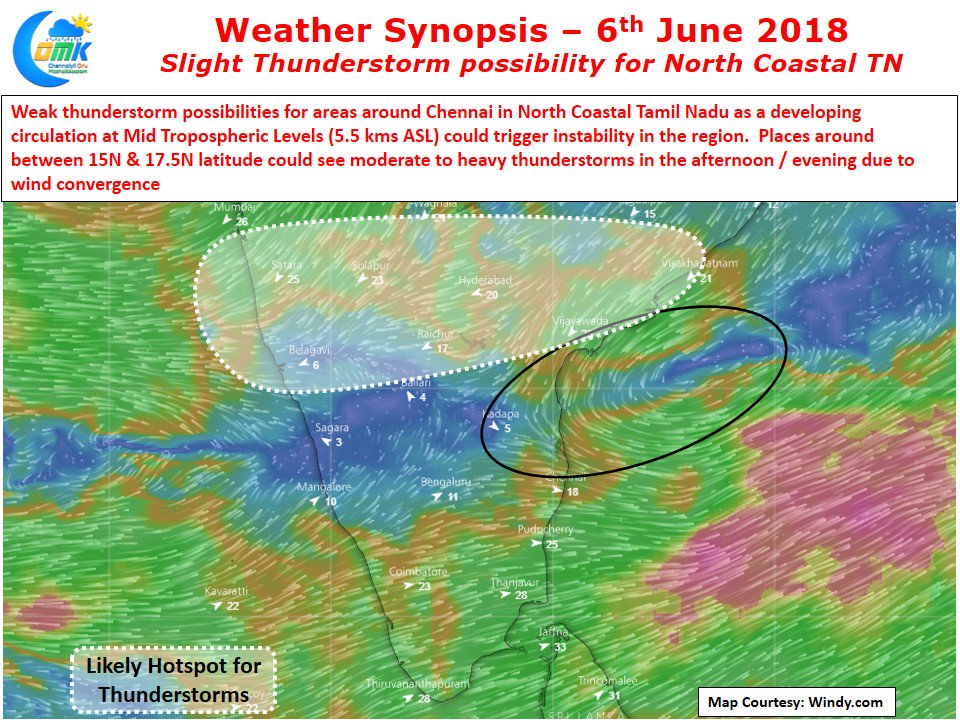
Thunderstorms so far has been Hit & Miss for parts of Coastal Tamil Nadu including Chennai. While the last couple of days have seen coastal areas around Puducherry, Chidambaram get some afternoon / evening thunderstorms slightly up North things have not been great for places like Chennai with either steering winds being weak or storms not forming at the right location. But this is normally the trend during the early days of Southwest Monsoon when things dont streamline well enough for Chennai to see full strength Westerlies.
Before the monsoon starts its active phase over the West Coast today could represent one last chance for North Coastal Tamil Nadu including Chennai to see some thunderstorm activity and possibly rains as well. While we are not saying these thunderstorms are guaranteed and a sure shot event looking at models the conditions look right for Chennai to get lucky with some rains finally after so many days of Hit & Miss. The past few days thunderstorms in Tamil Nadu and adjoining parts of South Int. Karnataka & Rayalaseema region were primarily out of the East West Shear Zone at 3 kms ASL instability. That zone is now around 15N Latitude and likely to give rains to places along the latitude of Vijayawada right from West Coast to East Coast.
But the possibility for thunderstorms in Chennai arise out of the developing Mid Tropospheric Circulation in Bay a precursor to the LPA in the coming days. This circulation is likely to create wind instability & convergence of winds to create thunderstorms around the region. Additionally with streamlined Westerlies now improving the chances of thunderstorms forming in the places around the West of Chennai due to convectional day time heating & Orographic Lift provided by the broken Eastern Ghats can make its journey towards the coast and in the process towards Chennai as well. After what could be another fairly hot day if the thunderstorms do make its attendance at Chennai it will be an indeed welcome relief for the citizens


