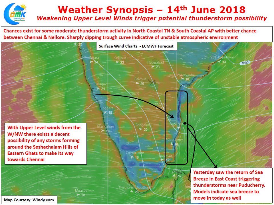
Just as the upper level Westerlies starts to show signs of weakening the models start showing thunderstorm possibility over the coastal areas of Tamil Nadu and adjoining parts of South Andhra Pradesh. After a fairly active spell of monsoon surge over most parts of South Karnataka including the catchment areas of Kaveri & Bhadra basin the Westerly winds are seen slowing indicating the slightly weaker phase of monsoon ahead.
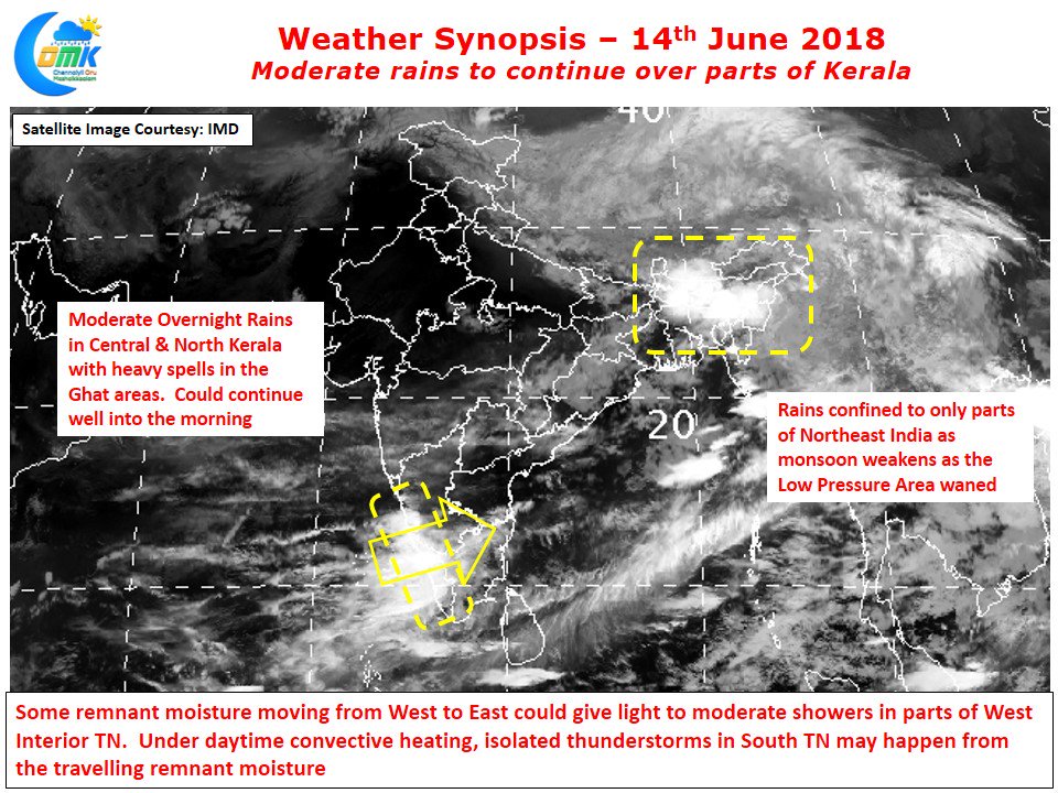
Central & North Kerala areas got moderate overnight rains at many places and few places along the ghats got heavy spells as moisture push from the Arabian Sea continue to remain south of 14 N Latitude leaving the Konkan coast seeing fairly dry weather since the day of onset. Few places in the Wayanad ghats have got very heavy rains which will augur well for the inflow into Kabini Dam. Let us not forget Kabini is much smaller than Hemavathi & KRS hence could fill up by end of this week or early next week which could be a blessing for Tamil Nadu.
As mentioned in the opening lines the Westerlies have weakened compared to the last few days. Yesterday saw the return of Sea Breeze over North Coastal TN bringing some thunderstorms near Puducherry. Models indicate today also for some sea breeze activity around South AP & North Coastal TN which will be the trigger needed for some thunderstorms to develop on the back of a Mid Level Wind instability which is indicated by the models. With upper level winds from W/NW some of these thunderstorms could make its journey towards Chennai too. The rains that are currently lashing Central & North Kerala will finds its way into West Interior TN bringing some light to moderate spells of rains while some of the remnant moisture is likely to trigger thunderstorm activity after day time convective heating in a few places of South TN.


