Yesterday saw the return of Rains in Chennai as Monsoon surge weakened over the West Coast. In our Tamil Blog we had made a post on how the “Veppa Salanam” or Convective Rains happen. In text book style yesterday’s Rains in Chennai had Sea Breeze Front influence the conditions, clear skies during the afternoon provide the necessary convective lift around places to the West of Chennai to bring the first batch of thunderstorms & Rains in Chennai.
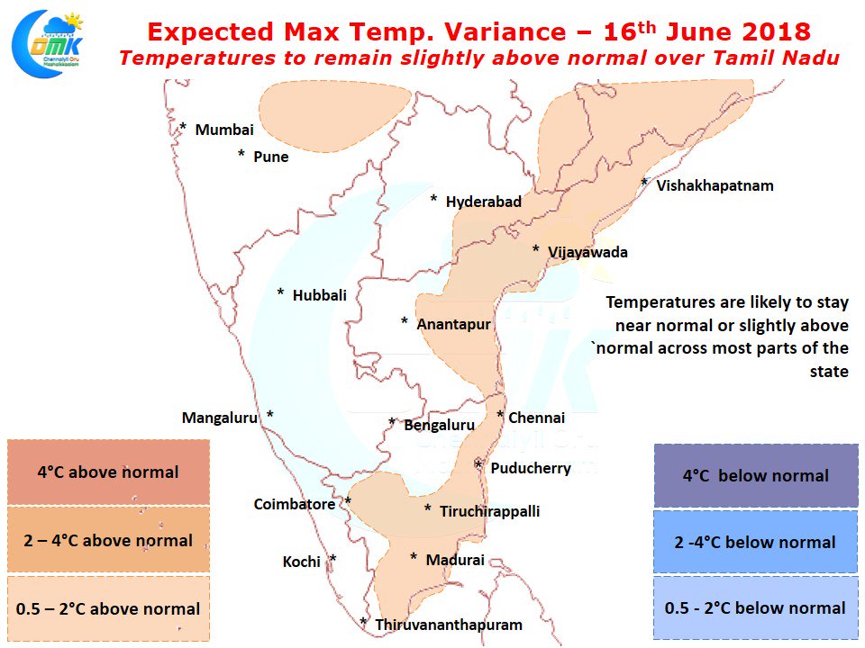
Like Yesterday today also is likely to be a fairly hot afternoon ahead with mostly clear skies after the remnant thunderstorms clear early in the morning. Models indicate most of coastal Tamil Nadu to see slightly above normal temperatures with Chennai in line for another go at the elusive 40°C. This is likely to create conducive conditions for thunderstorms to develop late afternoon as usual around the Eastern Ghats.
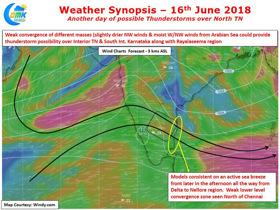
There is a slight convergence of winds at 3 kms ASL which could provide the necessary initial trigger for the thunderstorms to pick up along with convective factors. Closer to the coast models are consistent on an active sea breeze front influencing things later in the day bringing around another potential possibility of rains along the coastal areas from Delta to Nellore district. Individual places will depend on how the sea breeze moves inland. But a possible localized convergence North of Chennai gives a decent shot for Rains in Chennai and surrounding areas today as well.


