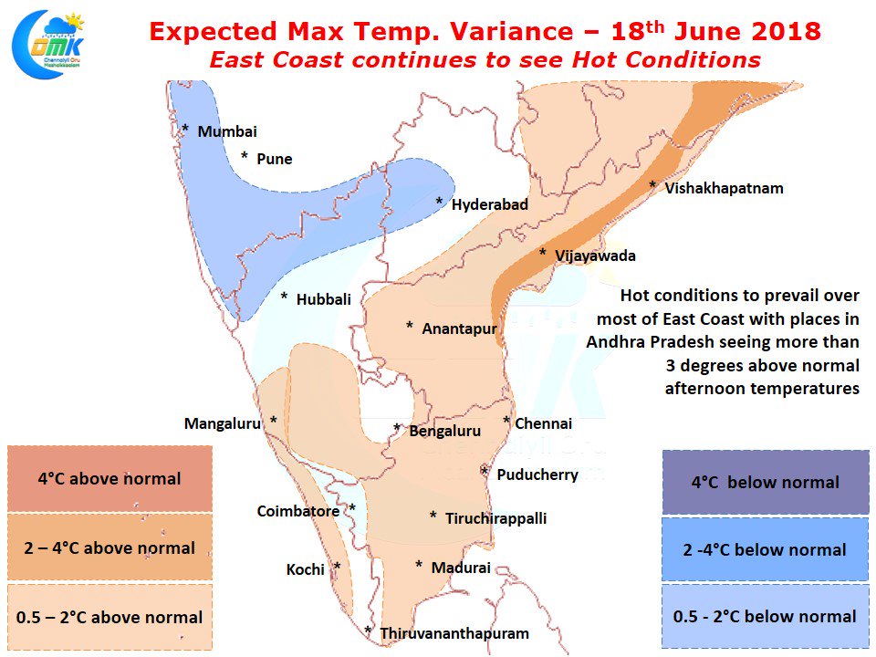
The month of June typically sees Hot conditions persist over parts of East Coast of India particularly over South Andhra Pradesh & North Tamil Nadu even though Monsoon makes its progress over the rest of the country. We have explained the reasoning many a times on how places like Chennai in the East Coast typically sees summer bloom late compared to the interior places of the state.
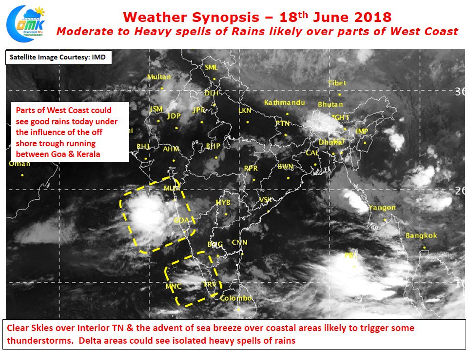
Under the influence of an off shore trough running from Goa to Kerala parts of West Coast is likely to see moderate to heavy spells of rains. Though this does not signify an immediate revival of monsoon it certainly sets the stage for increased monsoon surge towards middle of the week. Unlike the last time around this surge may not be as expansive due to lesser assistance from MJO, Early next week with slightly more favorable conditions we can start to see monsoon flex its muscle once again. With clearer skies the radiation has certainly increased over the last few days creating possible instabilities under convective heating.
Parts of Chennai saw evening thunderstorms yesterday with places in the northern parts of the city enjoying a better spell of rains. Going by model outputs we could possibly see an active day around the delta region under the influence of lower level convergence and also a weak instability at the upper levels too. Chennai will possibly see some thunderstorms develop triggered by sea breeze front later in the evening though with stronger Westerlies the storms will possibly push into the sea fairly fast giving sharp rains to where ever these storms cross.


