Last couple of days have seen fairly weak thunderstorms activity over North Tamil Nadu with yesterday seeing very subdued conditions right through the evening. While Monday saw some activity in the delta districts overall the thunderstorms caused by “Veppa Salanam” has been low since the turn of the week. Monsoon picking up over the West Coast is certainly playing a role in the reduction of thunderstorms over the Eastern coast.
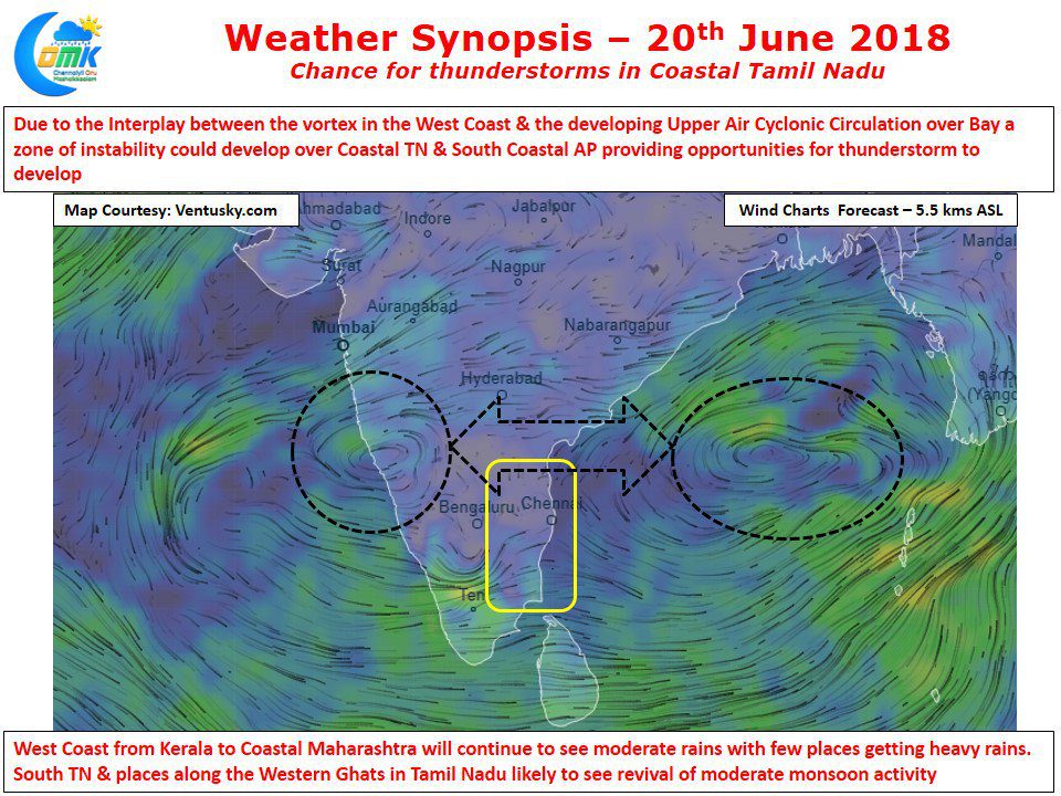
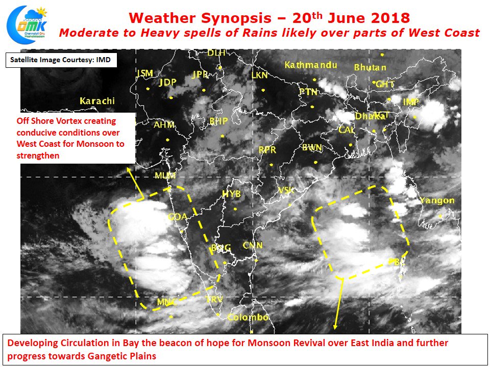
Things certainly look good for Monsoon activity over the West Coast under the influence of an Off Shore Vortex that is likely to circulation a fair bit of moisture around the coastal areas of Karnataka & Konkan regions. Along with these parts Kerala & the places in the right side of Western Ghats in Tamil Nadu is likely to see moderate rainfall activty. South TN in particular Kanyakumari district is likely to see decent rains in the comings days as Monsoon makes its presence count.
It could be a surprise to see a post hinting at possible thunderstorm activity in Coastal Tamil Nadu when monsoon has started to pick up. But yes a developing circulation in Bay of Bengal is likely to create favorable conditions for thunderstorms through an interplay with the already existing vortex over the West Coast. Models expect a zone of instability to happen over Coastal Tamil Nadu and adjoining parts of South Andhra Pradesh. Parts of delta districts could see some rainfall activity triggered by the intrusion of sea breeze from the South. While its difficult to judge the exact impact locations for Summer / Monsoon Thunderstorms it appears there is a good chance for Chennai & Suburbs to see a spell of late evening rains. Similar conditions are shown in models tomorrow though we need to see if changing monsoon dynamics realign the circulations & wind patterns.


