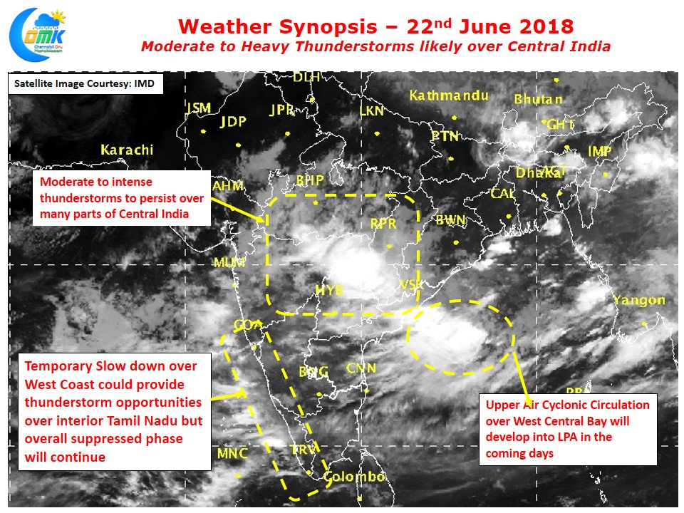
The last few days have seen fairly subdued phase of thunderstorms over most parts of South India disappointing a lot of weather bloggers who were optimistic on the back of some consistent model outputs. As many would say Vagaries of Weather once again proved it can have the laugh last despite a lot of technological advance & computing powers for weather models.
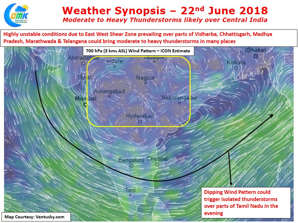
While Southern parts of Peninsular India has been seeing weak thunderstorms the Northern fringes of Peninsular India along with parts of Central India has been seeing an active phase of thunderstorm activity under favorable conditions. An East West Shear Zone – precursor of Monsoon moving into the areas has been prevailing around 18N latitude bringing the necessary instability for thunderstorms to thrive on. Additionally the slowly developing Upper Air Cyclonic Circulation over West Central Bay will provide the necessary synoptic support for these thunderstorms to continue over longer duration of time thereby giving some much needed rains for many areas of Central India like Vidharbha, Madhya Pradesh, Chhattisgarh etc.
As far as Tamil Nadu goes the temporary weakening of monsoon over the West Coast provides a window of opportunity for thunderstorms in the region though the overall suppressed phase is expected to continue today as well. We will have to see if things change tomorrow for the better. Nevertheless there is going to be one active day of thunderstorms for Coastal Tamil Nadu before the next active monsoon surge expected early next week.


