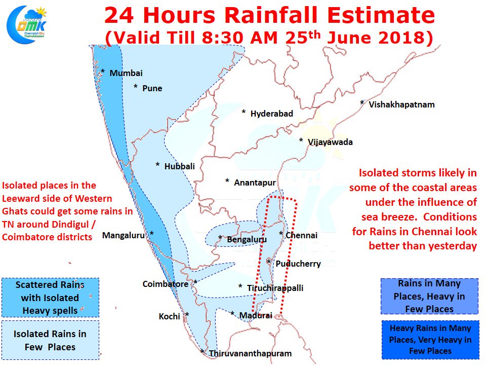
After few days of disappointment yesterday saw some spell of Rains in Chennai return back. In particular some of the Western and Northern suburbs of Chennai recorded moderate rains. While both the major IMD observatories at Nungambakkam & Meenambakkam missed out on rains the IMD weather stations at Puzhal & Madhavaram recorded 9 & 5 mm respectively. While active monsoon conditions may not be prevailing over the West Coast there is a reasonable amount of moisture surge along the West Coast. Because of this the typical break conditions are not seen over the Rain Shadow areas of Tamil Nadu minimizing the thunderstorm possibilities.
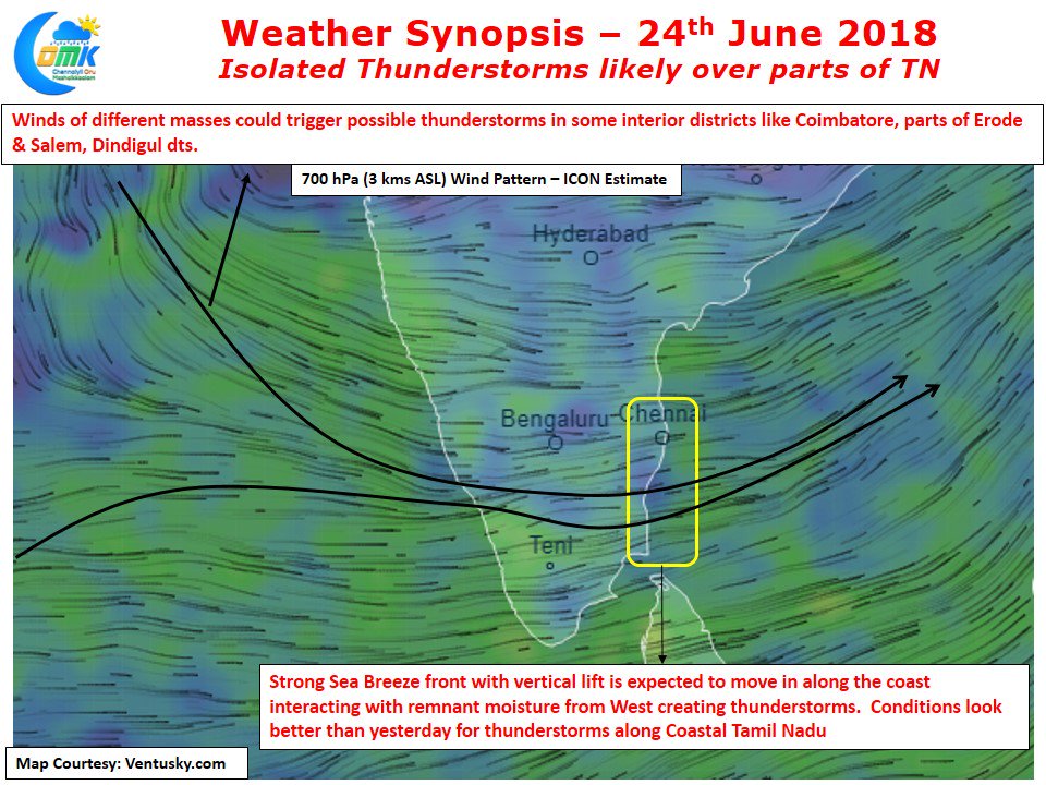
But moderate thunderstorms may develop in a few places along the leeward side of the Western Ghats under the influence of a weak instability created by winds of different air masses converging around the 10 N latitude. Similarly there exists a potential for a mid tropospheric instability as well though we are not sure how much this would translate into reality as a trigger for thunderstorms.
Coastal areas are likely to see another day of active sea breeze front with models indicating the sea breeze to climb vertically as well which will aid the instability creating thunderstorm possibilities when it interacts with the remnant moisture moving in from west. Looking at the conditions the possibility for Rains in Chennai is better than yesterday, a day which started with fairly poor conditions, so could be a good end to the week on the rain front. The stretch between Delta districts & Puducherry look likely to be a hotspot for thunderstorms today. As we always while there exists a good probability for Rains in Chennai we could end up seeing only clouds and no rains at all as Summer / Monsoon thunderstorm predictions are always fraught with risk of failures.


