The Bay has been active all season long but has been subdued for what ever reasons since the Northeast Monsoon started. But in a final push it is expected to end the season with a bang. If things go as per script expected by Models there could be a Marginal cyclone that would skirt the Tamil Nadu & Andhra Pradesh coast and move further North. How much North is debatable and pretty much academic till the actual system takes birth. A COMK take on the events that are expected to kick start around Christmas and wind up around New Year.
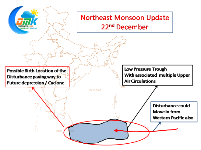
All season long the South Bay adjoining the equatorial waters has been active with regular troughs. As things stand the current low pressure trough around the area is expected to sustain till Christmas period. It already hosts multiple embedded Upper Air Circulation.
One such vortice is expected to push on to become an organized disturbance around Christmas.
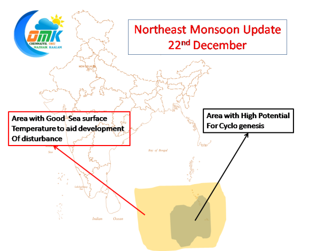
Both South East & South Central Bay currently has good Oceanic Conditions to aid further development of the expected disturbance. There is a possibility a pulse moving in from Western Pacific could become organized around South East Bay where possibly the best conditions exist.
The atmospheric conditions are also reasonably conducive though moderate shear is expected to remain around the South Bay. But the conditions are expected to be comfortable for the disturbance to overcome its birth pangs.
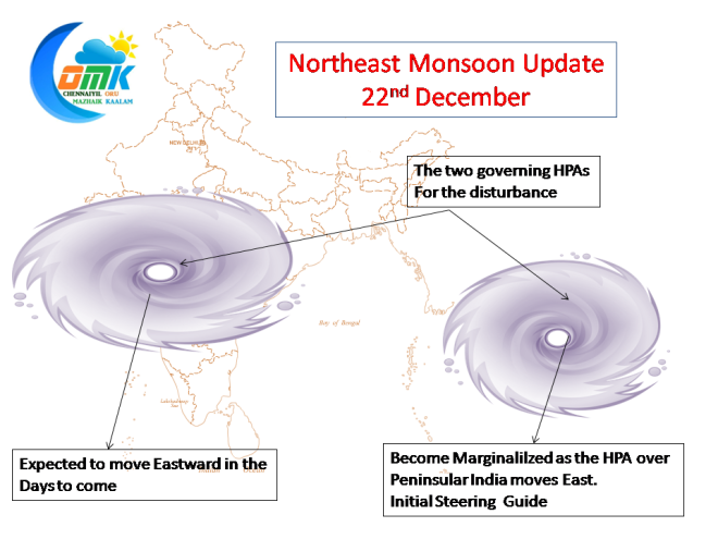
The two HPA over adjoining Myanmar and Peninsular India are expected to remain the guiding forces for this disturbance though the steering impacts would change depending on the intensity the disturbance picks up.
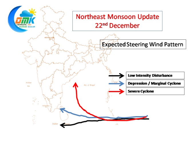
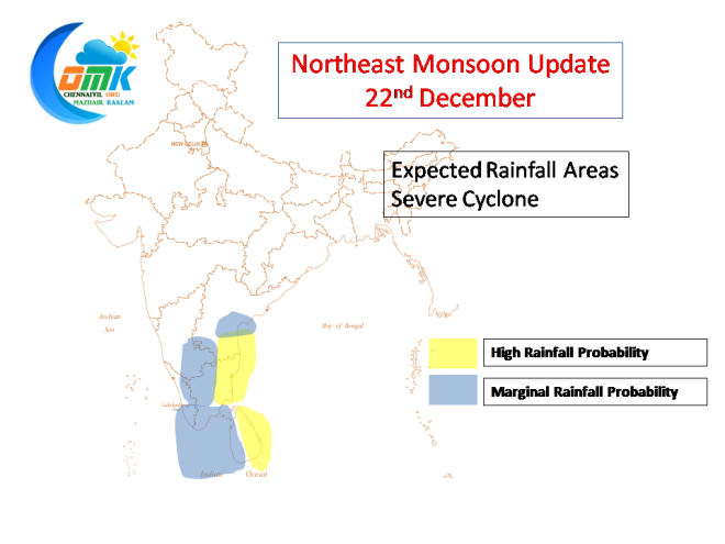
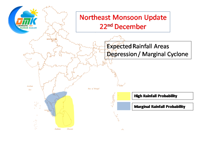
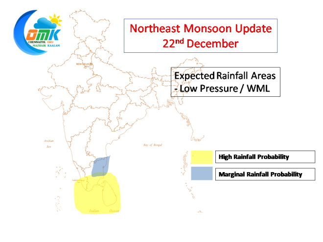
While its pretty much wishful thinking to expect a system of our choice and track of our wish even before the system actually forms, nevertheless we give the expected steering pattern at various intensity levels.
As one would observe from the above image the impact area would drastically chance based on the intensity. While we are not sure at what point the intensity would change so predicting a track now becomes irrelevant. Though we could possibly provide an indicative rainfall impact at the respective intensity levels.
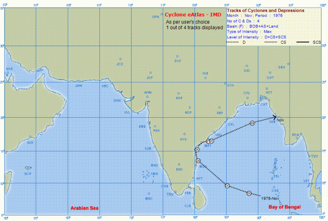
As of now let us sit back and watch the Bay unfold events at its own pace decided by nature. Let us hope for Chenna’s sake History repeats itself, a track of possibly one of the most intense rainfall systems Chennai got


