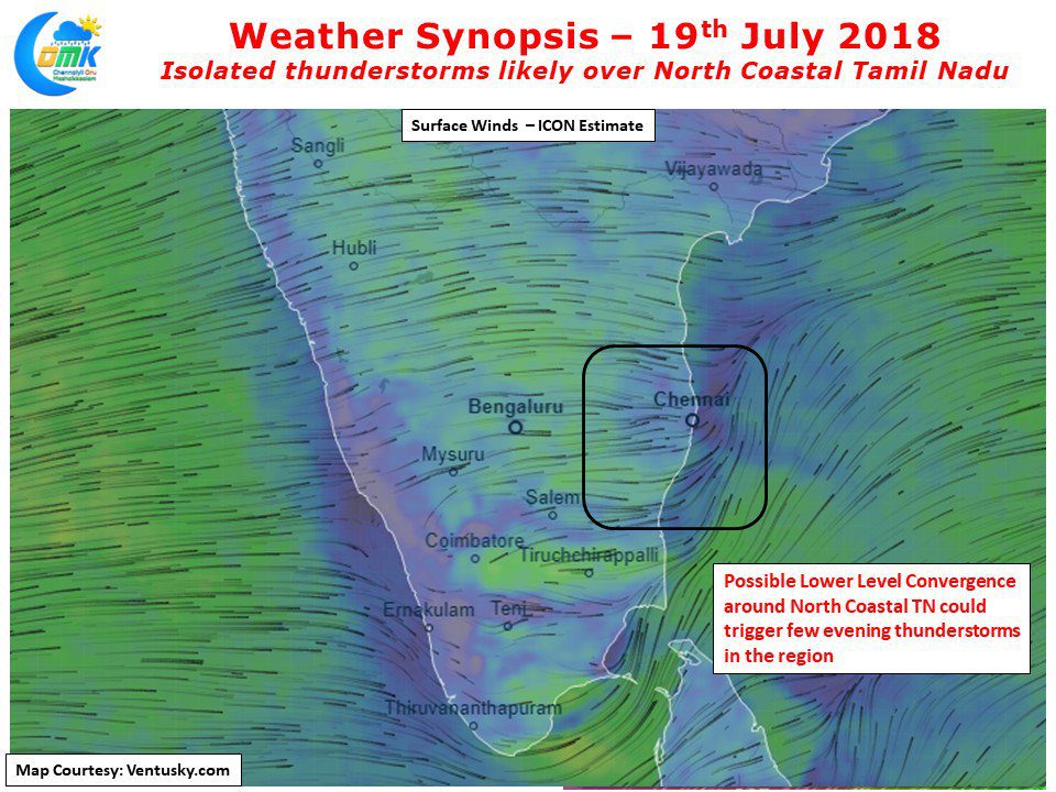
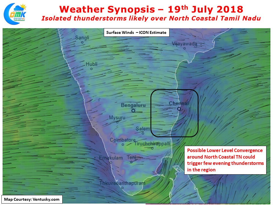
The last couple of days have seen some weak thunderstorm activity over North Coastal Tamil Nadu in particular around the suburbs of Chennai. On Tuesday some of the northern suburbs of Chennai recorded light to moderate rains while yesterday saw places around the southern parts of the city record moderate rains in the evening.
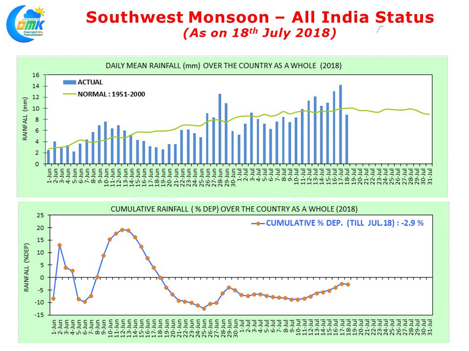
This phase has coincided with slightly weaker activity in the West Coast at the same latitude as Chennai. Overall though the last week to 10 days have been good for Southwest Monsoon with a lot of catching up done during this period. As of yesterday the overall performance is -2.9% short of the normal average for the period as of yesterday. A majority of this improved performance has come on the back of some heavy to very heavy rains in the Central Indian region aided by the Low Pressure Area that formed in Bay of Bengal.
With another Low Pressure likely to form in a day or two once these areas once again will get heavy rains. West Coast in Peninsular India is seen a subdued activity for the last couple of days which is a welcome relief to parts of Kerala & Kodagu region that has been reeling under intense water logging & flooding throwing normal life out of gear. Before the monsoon takes a break in a week or 10 days time there will be another spell of fairly active monsoon conditions in Peninsular India. Coastal Tamil Nadu is likely to see another hot day ahead as has been the case for the past few days. This increased heat is creating a temperature gradient allowing weak sea breeze front to move in isolated places along the coast triggering thunderstorm activity. Numerical Models indicate a lower level wind convergence off the Chennai coast which is likely to trigger thunderstorm activity over few places in North Coastal Tamil Nadu. There is fair chance for one or two places in and around Chennai to see moderate rains on account of this.


