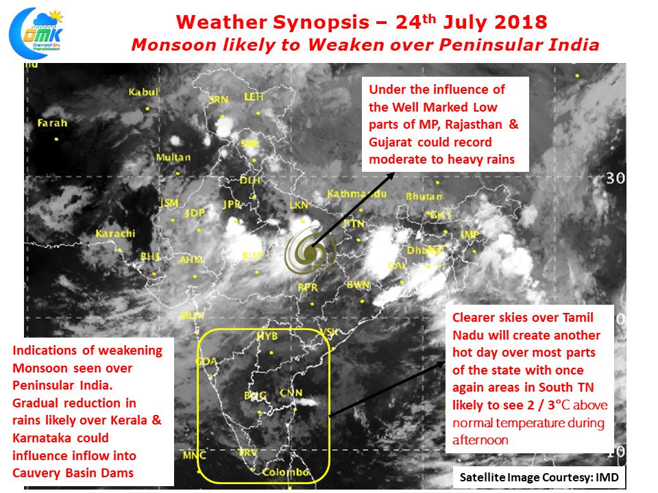
After a Non Stop Run for more than 2 weeks Monsoon is showing signs of weakening over Peninsular India. Though the Well Marked Low continues to persist over Central India Southwest Mosoon is possibly getting ready for a break phase over South India & West Coast. Numerical Models have been indicating this subdued phase of rainfall activity for a few days now.
The Well Marked Low currently prevailing over Northeast Madhya Pradesh & adjoining areas is likely to provide heavy rains to many places in the region with parts of Gujarat, Rajasthan & MP along with few areas of Uttar Pradesh likely to see moderate to heavy rains. This is likely to persist for another day or two before things start easing there. Models indicate another possible Low Pressure Area to form around Bay early next week though we will have to wait and see if this indeed happens.
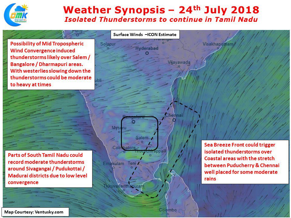
The signs of weakening Monsoon triggers a set of changes in atmospheric conditions over Tamil Nadu. With clearer skies the temperatures tend to spike up during afternoon with slightly above normal temperatures expected today also over most parts of the state. The Weakening westerlies provide a window for Sea Breeze Front over coastal areas bringing forth thunderstorm possibilities along with it. Yesterday saw few areas of Chennai record light rains, today also we could see some rains in a few areas with model outputs indicating decent chance for the stretch between Puducherry & Chennai.
South TN has been bearing the brunt of the increased heat quotient due to weakening monsoon. Madurai AP recorded 39°C yesterday making it a very hot afternoon for the Temple City. But the good news is probability of thunderstorms now pick up for South TN with Madurai, Pudukottai & Sivagangai districts in with a chance for some moderate thunderstorms during late afternoon / evening due to lower level wind convergence. Interior areas around Salem / Bengaluru also could sneak a spell or two on the back of a Mid Tropospheric Wind instability in the region.


