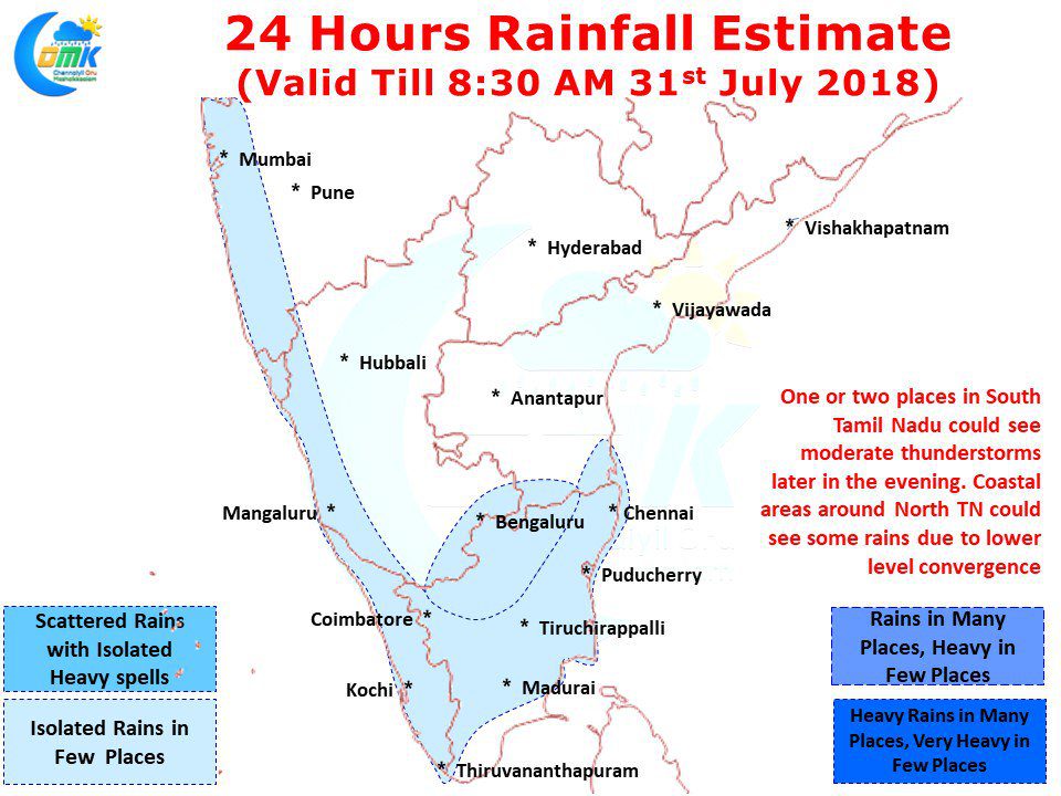
Last evening saw parts of Chennai receive short spell of sharp showers from thunderstorms triggered by the sea breeze front interacting with upper level Westerlies. While the IMD observatory at Nungambakkam recorded 7 mm the one at Meenambakkam recorded traces. The thunderstorms intensified closer to coast giving sudden burst of heavy rains which lasted only for few minutes.
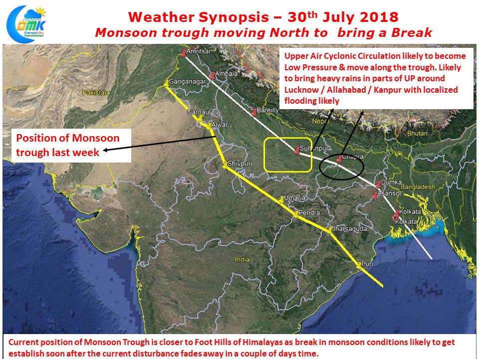
Most of Tamil Nadu saw fairly dry conditions with one or two places in parts of Madurai & Pudukottai district along with isolated places in delta district saw light thunderstorms in the evening. While West Coast has been seeing dull monsoon conditions thunderstorms have not picked up over Tamil Nadu much to the disappointment of weather observers. With no proper break in monsoon conditions setting yet atmospheric instabilities are missing over Peninsular Region improving the chances of thunderstorms. This though could change for the good with Monsoon Trough now moving North compared to last week getting closer to the foot hills in the process.
Today we are likely to see some Mid Tropospheric Wind instability around 11N latitude bringing potential thunderstorms to parts of South TN, West Interior TN & delta districts. One or two places around Madurai / Pudukottai / Salem could get moderate rains in the evening. After what is likely to be another fairly hot day across the state coastal areas of North Tamil Nadu could see thunderstorms triggered by lower level convergence. Unlike the storms of South TN which could be slow moving thunderstorms in northern parts of the state could be fast moving.


