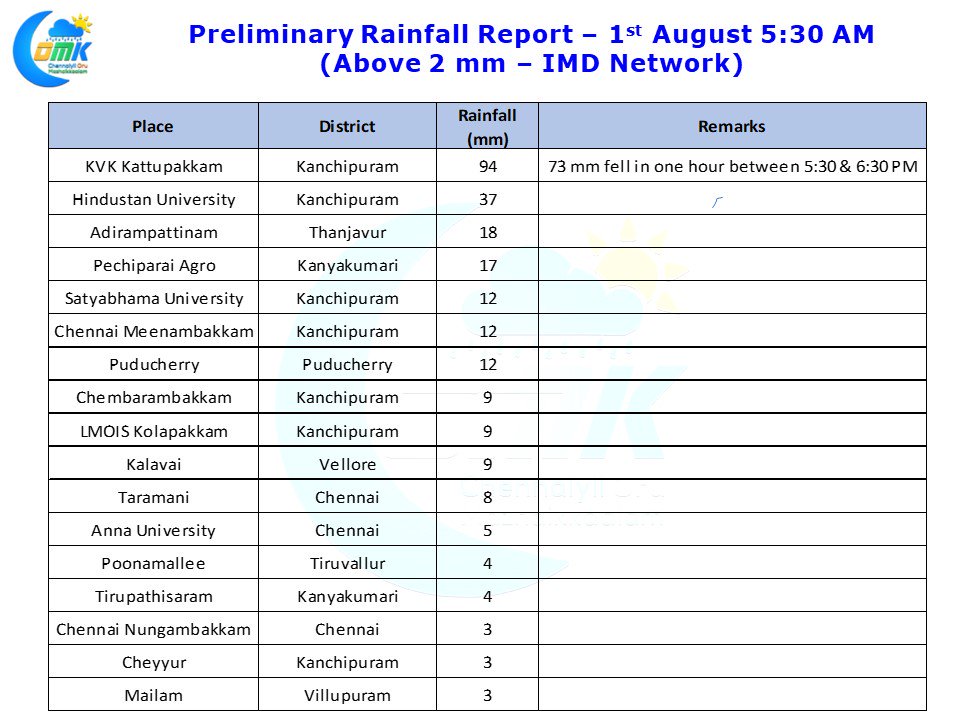
Last evening saw intense spell of rains lash Chennai & Suburbs bringing a cheer to many people. While the core city areas of Chennai got light to moderate spells of rains the southern suburbs enjoyed a very strong spell of thunderstorm with the IMD Automatic Weather Station at KVK Kattupakkam, 30 kms to the south fo Chennai recording more than 9 cms of rains of which 7 cms fell within an hour between 5:30 & 6:30 PM bringing traffic to near standstill around the areas. As weather bloggers nothing give us more joy than to say “Intense Rains Lash Chennai”.
Yesterday as explained in our Tamil Post the wind instability that was expected by the Weather Models worked favorably for Chennai in an interplay with lower level convergence triggered by a fairly strong sea breeze front. Past few days the thunderstorms were purely triggered by the intruding sea breeze mechanism which meant storms were not intense and saw a shorter life cycle too. But yesterday we had an overall wind instability mechanism providing a conducive environment for the storms to develop & thrive.
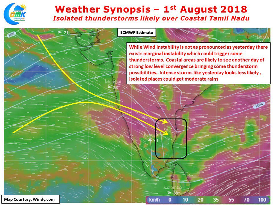
As we often mention its difficult to estimate the day after a heavy thunderstorm activity when weather models are yet to realign their equations incorporating the thunderstorm activity. Especially when intense thunderstorms happen on a day when it was originally estimated models tend to go slightly out of sync with outputs for the subsequent 24 – 36 hours. Looking at the wind charts for today it appears the instability is likely to be less pronounced compared to yesterday and hence sever thunderstorm possibility for places in Tamil Nadu looks less likely. Nevertheless we will continue to see strong lower level convergence triggered by the sea breeze front which will give isolated thunderstorms in coastal areas of Tamil Nadu like Chennai etc. We will monitor the early morning model outputs to see if the instability returns and update accordingly if need be


