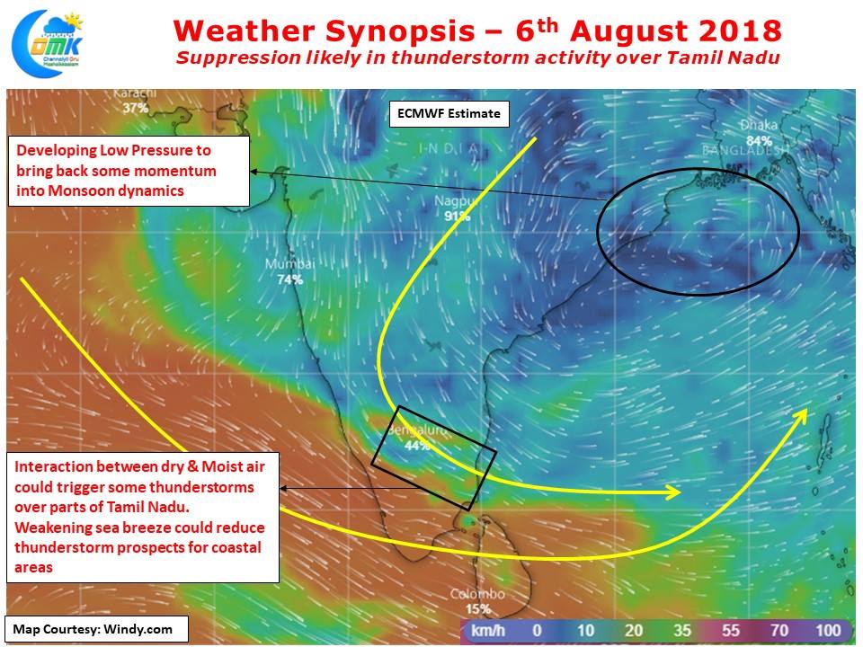
After few days of fairly active thunderstorm activity over many parts of Tamil Nadu things are likely to go through a slightly weak phase over the next couple of days under the influence of the developing Low Pressure in North Bay area. Currently lying as an Upper Air Cyclonic Circulation & expected to deepen over the next 24 – 48 hours it will become a Monsoon low by tomorrow
As the Cyclonic circulation deepens & develops a surface level circulation to be called a Low Pressure Area the Westerlies will become more streamlined removing the possibilities of wind instability induced thunderstorm activity. With increased westerly wind speeds it makes formation of thunderstorms difficult. This is also likely prevent the development of strong sea breeze front, another important component for thunderstorm activity in coastal places like Chennai. The streamlined Westerlies also remove the mixing of dry & moist air providing conducive conditions for thunderstorms to develop.
Today we could see some thunderstorm activity around the central parts of the state due to this condition though overall the rainfall possibilities are slowing down for Tamil Nadu. Numerical models indicate westerlies to strengthen in response to the Head Bay Low pressure bringing back some rains to the West coast as a possible off shore trough develops.
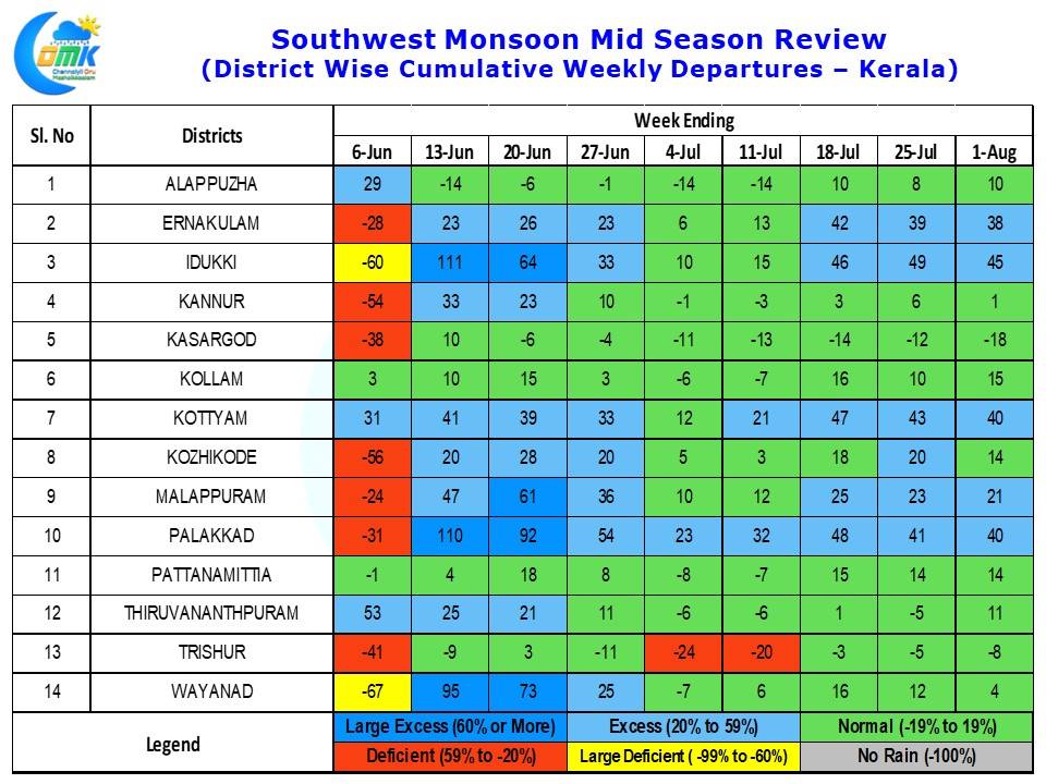
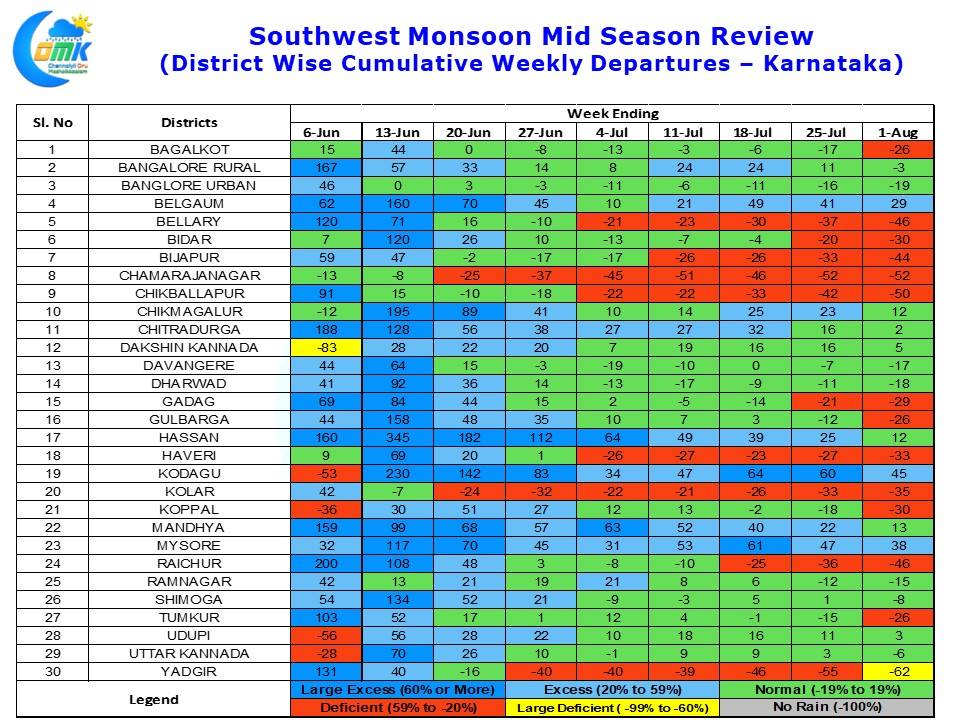
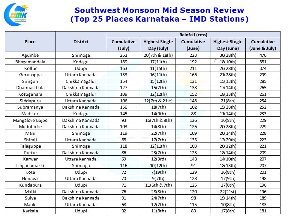
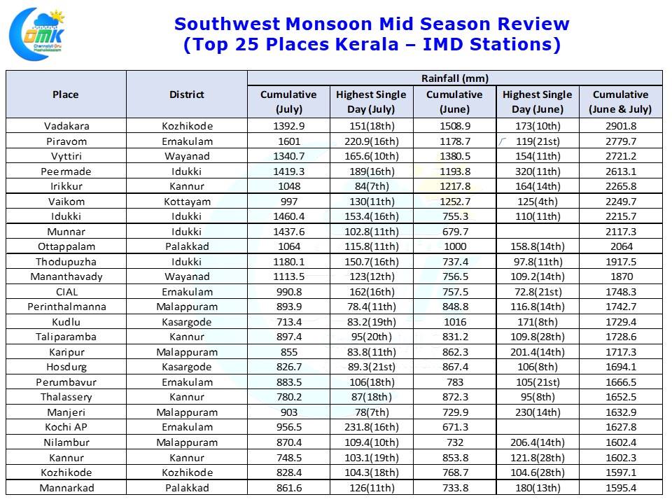
This is much needed revival of monsoon even though it may not be very strong as the cumulative district wise weekly rainfall chart indicates for Kerala & Karnataka. While Kerala is still maintaining a good status so far parts of Karnataka are slipping badly indicated by the increased Red Cells in the chart. Thanks to Natarajan who has been patiently compiling the rainfall statistics from IMD reports we are also giving the Top 25 IMD stations of Kerala & Karnataka for the first half of Monsoon, June & July, the list pretty much sums up the role of Western Ghats in these heavy weights getting tremendous rains during this period.


