The Bay Low Pressure continues to evolve slowly with IMD expecting it to be come a depression in the next 24 hours or so. Currently pretty much stationary over the region between Andaman Islands & Chennai it lies in a zone of high shear which possibly is going to go against the system intensifying rapidly over the course of the next couple of days.
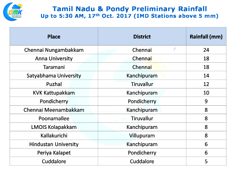
In the meanwhile many parts of Chennai got light to moderate spells of rains in the evening while cloudy skies with intermittent drizzle set the tone for most of the day yesterday under the influence of the Bay Low Pressure. The highlight has to be IMD Observatory in Nungambakkam getting 24 mm which will take the seasonal tally to 135 mm roughly 35 mm above average for the period so far.
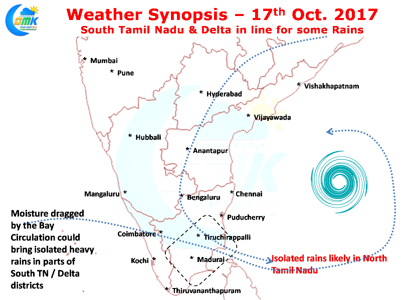
As mentioned in our opening lines the system currently lies to the East of Chennai with marginal improvement compared to yesterday in terms of overall structure and intensity. In all probability we will see it become a depression today and head in a NW direction towards AP / Odisha coast in the next couple of days. Thanks to the moisture drag created by the Bay Low Pressure parts of delta districts and South TN will enjoy a day of rains today.
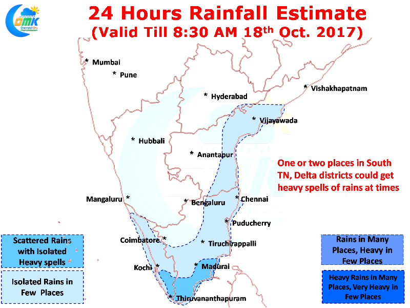
Isolated places in South TN & Delta districts could get heavy spells at times with mostly light rains through the day. Cloudy skies is expected to dominate most parts of Tamil Nadu with rest of the state, in particular, North Tamil Nad enjoying occasional spells of light rains.


