As the interiors continue their show Bay of Bengal has been churning slowly to bring about the seasonal change of winds from Westerlies to Easterlies. More on that a little later. Yesterday saw parts of South Tamil Nadu & West Interior Tamil Nadu enjoy a very good day of rains as places like Coimbatore was hit by moderate rains with the western suburbs of the city enjoying much heavier spells of rains during the day. With yesterday’s spell of 23 mm Coimbatore has now completed its annual rainfall quota of 59 cms joining Vellore. The next two IMD observatories to complete their annual quota in all probability will be Dharmapuri & Uthagamandalam both of which require less than 3 cms to reach the mark.
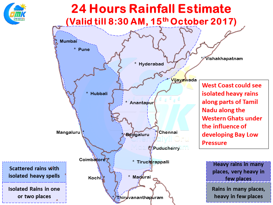
Today once again parts of West coast could see rains thanks to the moisture drag created by the developing Low Pressure in Bay of Bengal. Along with West Coast places along the Western Ghats in Tamil Nadu could enjoy a good day of rains with one or two places in the ghats getting heavy spells of rains. In the interiors once again districts like Vellore, Krishnagiri are ideally placed for a batch of evening thunderstorms.
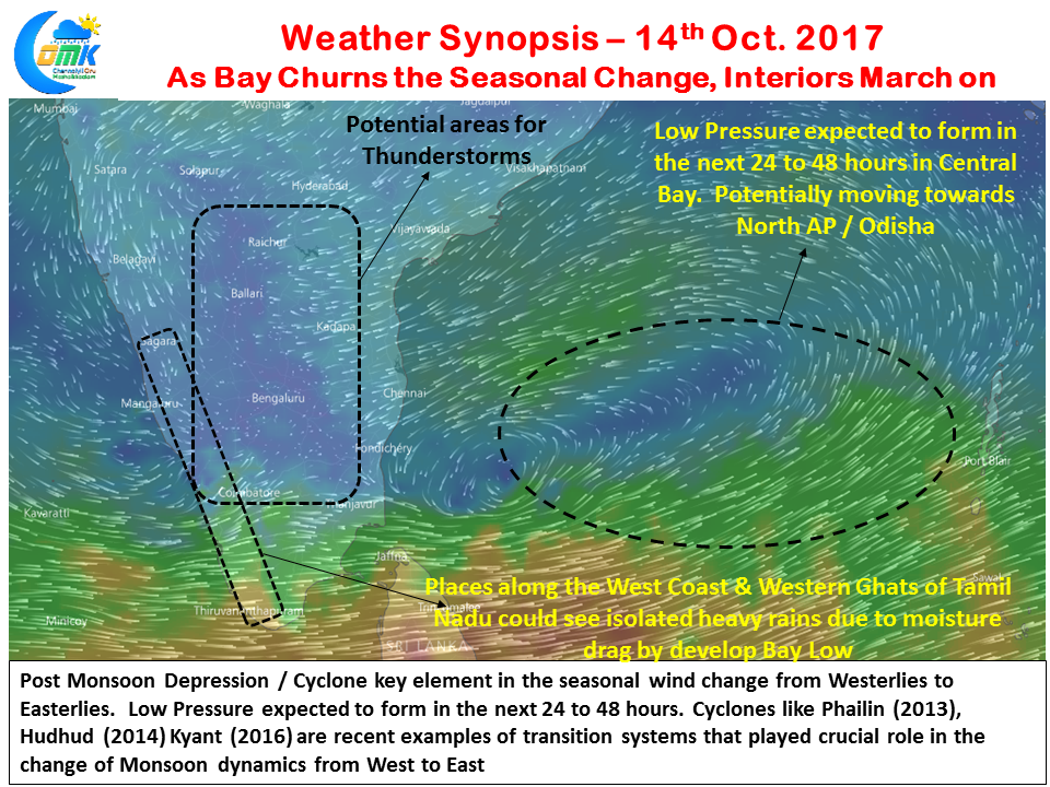
As we have mentioned many times in the past Post Monsoon Tropical disturbance is a key element in the seasonal with change process. While Southwest Monsoon withdraws on its own dynamics from the rest of India, the final piece in this seasonal change puzzle is more often than not the Post Monsoon Transition Tropical Disturbance. Cyclones like Hudhud, Phailin, Kyant in the recent years are classic examples for these transition systems.
Models are in tight agreement about a possible Low Pressure to happen in Bay of Bengal around the Central Bay region in the next 24 to 48 hours. The exact genesis point will hold the key in subsequent movement and possibly intensification & the landfall possibilities. At this moment we will take one day at a time and keep a close tab on this key trigger for the onset of Northeast Monsoon.


