The relentless march of thunderstorms in Tamil Nadu since the turn of October has been continuing with yesterday also seeing many interior parts of the state getting good rains under the impact of wind instability induced conducive atmospheric conditions. In a welcome news parts of South Tamil Nadu also recorded good rains with places like Kamudhi getting rains after a long break.
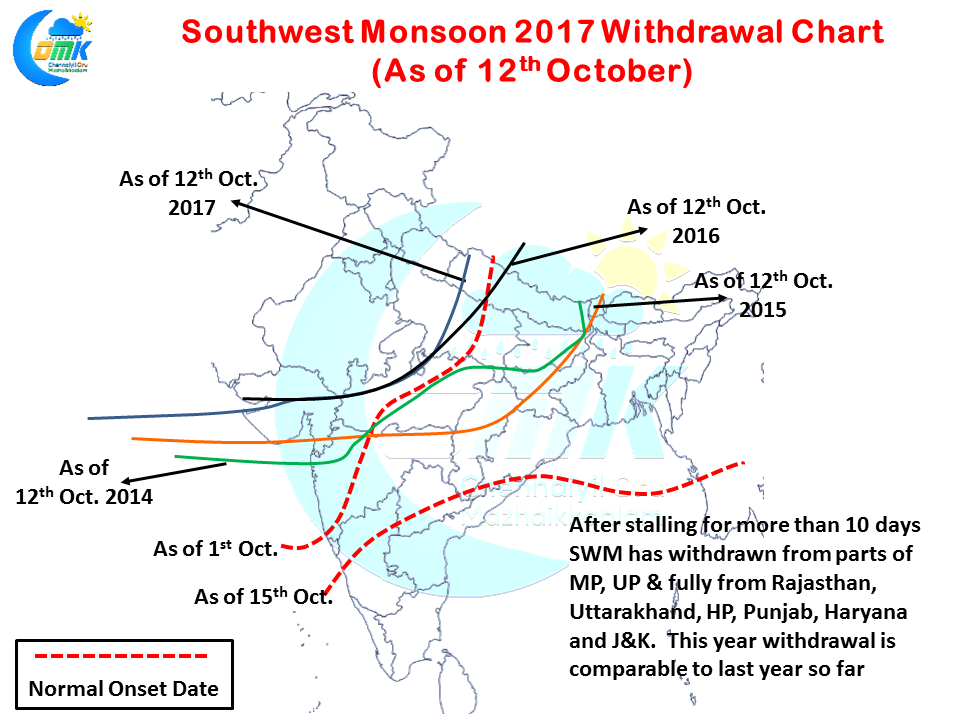
In another piece of good news Southwest Monsoon has started to withdraw once again after stalling for more than 10 days in Northwest India. With things in place for further withdrawal we could see some daily movement on the withdrawal line in the coming days. If one were to compare this year’s situation to last couple of years, we are at similar time frame to 2016 while 2015 and 2014 pretty much was well advanced in terms of withdrawal.
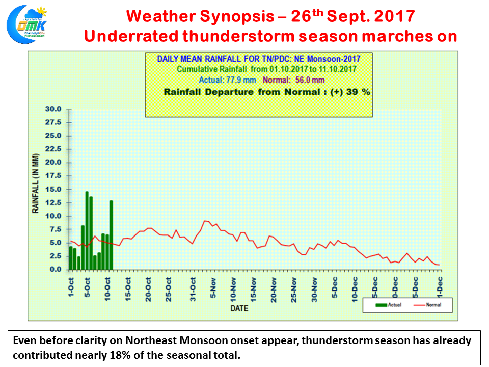
As mentioned in our opening remarks the thunderstorm season has been pretty much the silent performer for Tamil Nadu this year. Just like Southwest Monsoon period where thunderstorms contributed to excess monsoon for TN & Pondy since the turn of October the Northeast Monsoon seasonal tally scoreboard has been briskly updated by the thunderstorms. As of yesterday while the sub-division is at 39% excess it has already contributed 18% of the seasonal tally with no clarity on the Northeast Monsoon onset yet.
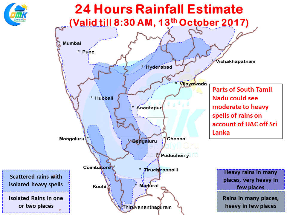
Interior places of South India will continue to see thunderstorms with the areas around Rayalaseema, Int. Karnataka, parts of NW Tamil Nadu and coastal AP likely to see moderate to heavy thunderstorms in a few places. Like yesterday parts of South Tamil Nadu and South Kerala could also see moderate rains in a few places on account of the Upper Air Cyclonic Circulation that has been persisting off the coast of Sri Lanka


