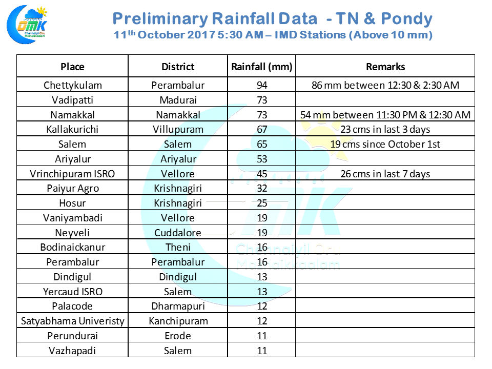
The story of daily thunderstorms in Interior Tamil Nadu continues as yesterday also saw many places of the state get moderate to heavy rains from late night thunderstorms. A few notable mention from yesterday include Perambalur, Ariyalur, Salem, Madurai, Villupuram, Vellore Krishnaigiri & Tiruvannamalai districts. Chettykulam in Perambalur district recorded nearly 9 cms in a two hour spell around midnight as slow moving thunderstorms dumped rains in the areas it passed through.
Places like Salem, Vrinchipuram & Kallakurichi indicate the interior story that has been unraveling this October. Salem has got about 19 cms since the turn of October which is more than 50% of the overall average of rains expected for the three month NEM season. Vrinchipuram in Vellore district has got 26 cms in the last week or so while Kallakurichi has got 23 cms in the last 3 days with more than 30 cms since the turn of October.
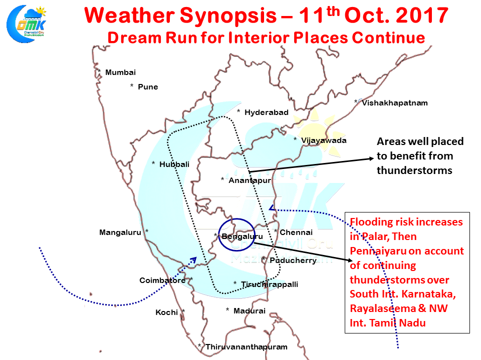
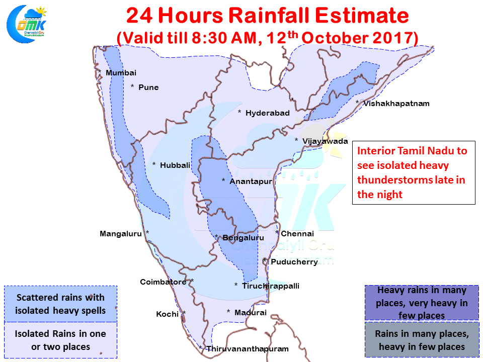
Today a similar story is going to get enacted for the interiors with a low level wind convergence well placed to induce the thunderstorms over parts of Interior Tamil Nadu, Karnataka & Andhra Pradesh. Isolated places in Northwest Tamil Nadu could get moderate to heavy late night thunderstorms under unstable atmospheric conditions. With rains expected to continue around the Karnataka, AP & Tamil Nadu tri-junction there exists an increased flooding risk for the rivers like Palar & Then Pennaiyaru around the districts of Krishnagiri, Vellore & Tiruvannamalai.
While coastal places like Chennai continue to miss out, things look good for a few places in Delta districts to get a spell or two of moderate rains today. Things certainly improve as far as wind pattern for Chennai as well with winds becoming little more westerlies, this could bring in some late night / early morning rains to the city though widespread thunderstorm activity continues to be elusive for the past few days.


