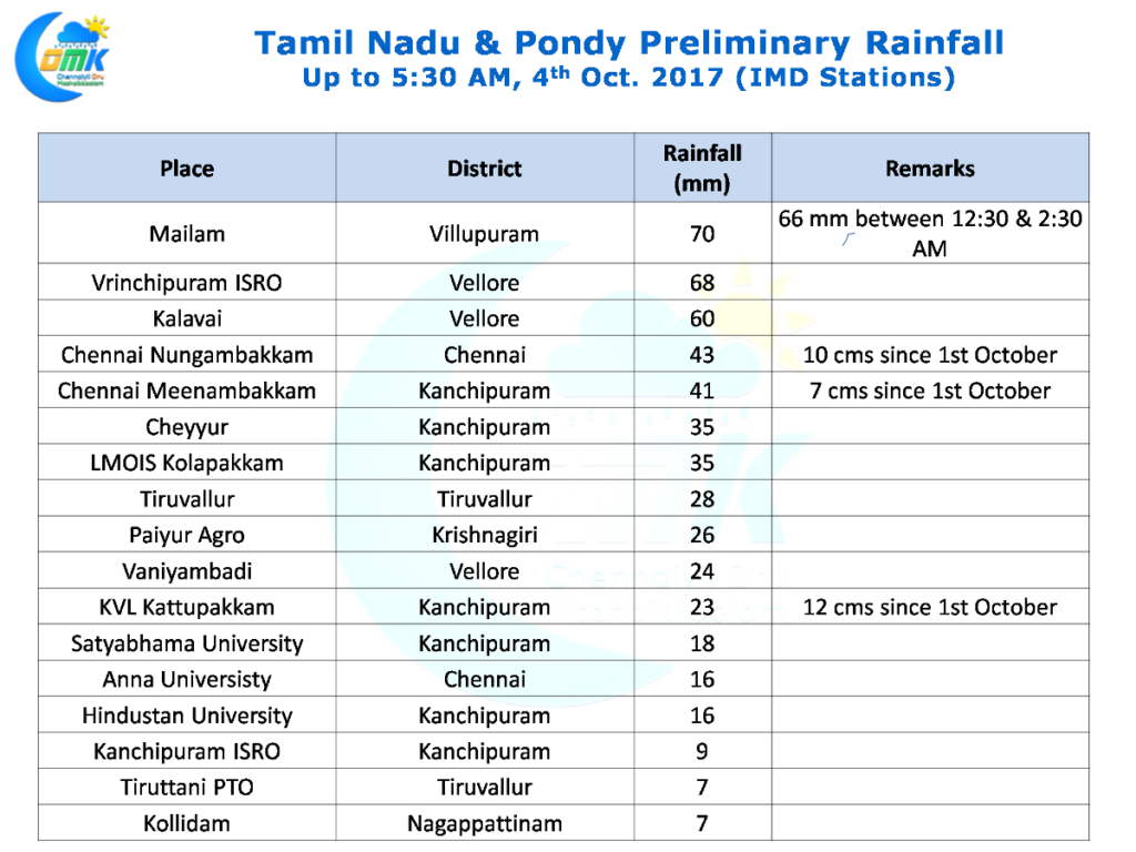
The thunderstorm season continues to flex its muscles on a daily basis with North Tamil Nadu enjoying a day of moderate rains at many places and isolated heavy rains in a few places. Chennai received fairly wide spread rains with most parts of the city recording moderate rains amidst intense sound and light show that rocked the city. Both the IMD observatories in the city crossed 4 cms for the day. Yesterday was only for the 3rd time both stations have crossed 4 cms the same day since the start of Southwest Monsoon 10th July & 18th August being the earlier occasions.
KVK Kattupakkam possibly signifies how active thunderstorms have been since the start of October with all 4 days so far recording at least 10 mm and the overall number being 12 cms as of today morning. Special mention should be made for Mailam as well which recorded more than 6 cms in a two hour burst around midnight as the storms moved with a clear Southward slant.
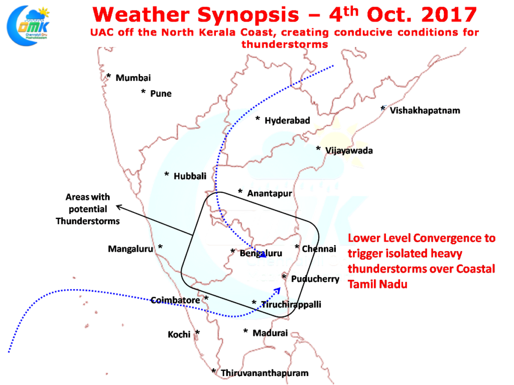
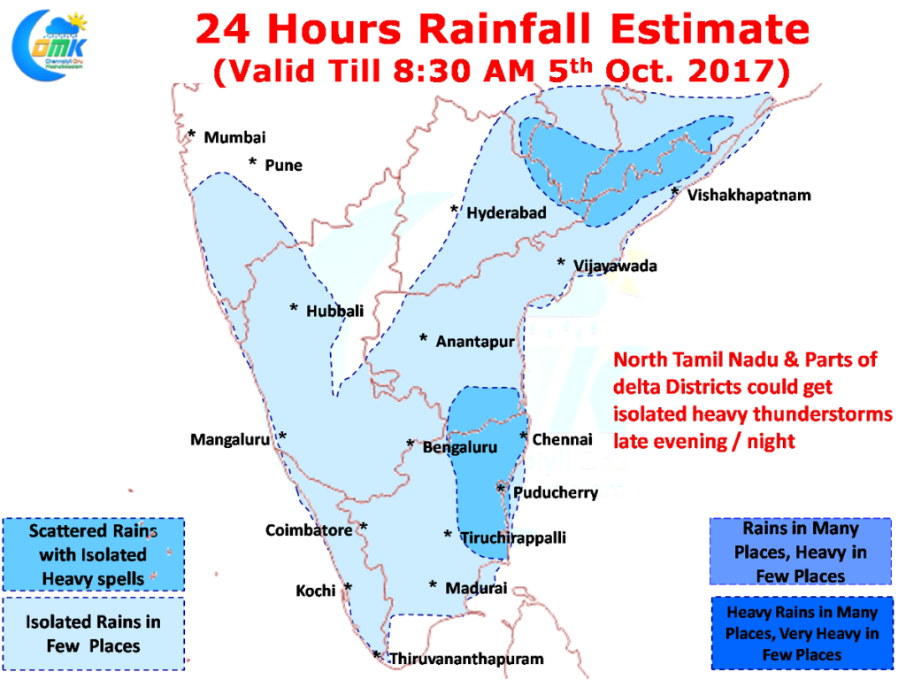
Another day of late evening / night thunderstorms await Tamil Nadu today with wind conditions favorably placed. Similar to yesterday there is likely to be a low level convergence over parts of South India with the UAC off North Kerala bringing the convergence zone slightly to the south compared to yesterday. This is likely to be beneficial for more parts of Tamil Nadu unlike the last couple of days when primarily North & Northwest TN were the biggest beneficiaries.
Additionally the coastal areas from Delta to SHAR seem to fall on the right side of the trough line which could enhance the conditions and intensity of the thunderstorms when they move from interiors to the coastal areas. This could result in one or two places in the coastal region of Tamil Nadu to get intense burst of thunderstorms with heavy spells of rains. While models indicate possible delta district to get the better spells it could be anywhere between Pulicat & Nagappattinam depending on the genesis of the original interior storms and the subsequent steering.


