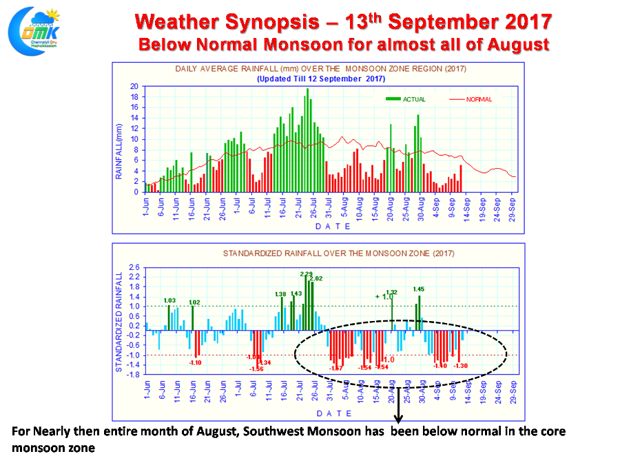
Southwest Monsoon which has been going through a very weak phase since the turn of August 2017 is set for a final thrust over the West Coast before the wheels of the motion for the seasonal change towards “Chennaiyil Oru Mazhaikaalam” starts rolling. It is an understatement to say August has been pretty much a disaster for the core monsoon zone. This cannot be highlighted better than the daily mean rainfall used to track active & break phases of Southwest Monsoon.
As one can see from the chart since 30th July the graph sees predominantly red bars an indication of the below average rainfall for the respective days. Only 7 days since then has seen the daily rainfall exceed the long term average for the day. A long period of break in monsoon period with the trough parked near the foothills of Himalayas resulted in this weak monsoon activity. Tamil Nadu benefited the most from this sequence of events resulting in one of the best August in recent times.
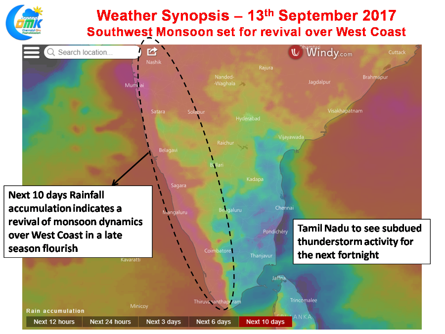
All this is expected to change int he coming days with the West Coast set for a revival as Southwest Monsoon makes a late season flourish. In what could be an interesting analogy this will possibly reflect like a late innings MSD attack to convert a par for course target into a above par target. While in the immediate context the trough running from Central India & the Upper Air Cyclonic Circulation in Arabian Sea will start the revival process, things are expected to pick up from the end of the week / early next week due to the incoming Monsoon Low from Bay of Bengal.
All in all the next fortnight looks like an active Southwest Monsoon phase will be kick started. The immediate consequence for Tamil Nadu is the subdued phase of thunderstorm activity for the next week or so. In the slightly long term context will this late season revival play a destructive role in the withdrawal of Monsoon on time to bring in the Retreating Monsoon aka Northeast Monsoon on time needs to be watched.
Powered by WPeMatico


