Today is likely to kick off what is going to be a very active spell of rains over most parts of Tamil Nadu for the next few days. A completely scrambled wind pattern at various levels over Tamil Nadu is setting up the stage for some widespread rainfall over the state almost resembling a Northeast Monsoon day instead of Southwest Monsoon season.
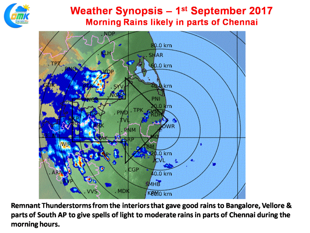
We will break down the day into two different events. The first event will be that of morning rains likely over parts of Chennai due to the movement of the remnant thunderstorms from the interiors. These spells are likely to be light to moderate spells of rains in a few parts of the city. Unlike Northeast Monsoon time they cannot sustain for long hours after day break hence could dissipate around 9 AM. So the rains for Chennai has to happen before that
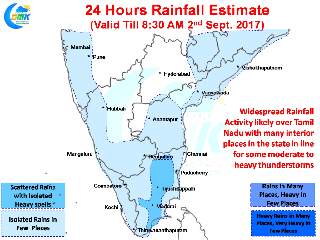
The second event will be possibly the widespread rainfall activity which is likely to happen over Tamil Nadu with wind instabilities present in different layers over parts of Tamil Nadu giving necessary impetus for the storms to breed. Like yesterday the events could unfold slowly after the sun is down with good rainfall activity to pick up from late evening.
The show is primarily going to be an interiors show though some of the coastal areas can get benefited while the storms cross coast and intensify due to coastal convergence.
Powered by WPeMatico


