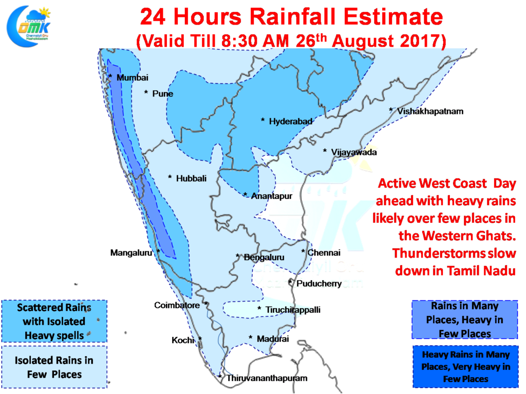
The month of August has been pretty much extraordinary for Tamil Nadu with most parts of the state enjoying a very good thunderstorm season. But all this is expected to come to a slow down as the next few days are likely to see thunderstorms reduce in Tamil Nadu and possibly except for some isolated spells overall rainfall pattern expected to be weak in the state.
The west coast is expected to pick up pace with isolated heavy rains likely in a few places along the Western Ghats between Karnataka & Konkan. Mumbai saw moderate to heavy spells of rains yesterday and a similar situation is expected today as well. With monsoon dynamics picking up thanks to the now less marked Upper Air Cyclonic Circulation over Coastal AP / Odisha we can see the rains return to Konkan coast though models are still not in sync about better prospects for Coastal Karnataka & Kerala.
Quiet day ahead for most of TN with possibly isolated thunderstorms in South TN triggered by coastal convergence while isolated thunderstorms may happen around NW interior TN. With westerlies picking up we could possibly see a lesser influence by sea breeze for the next few days over North Coastal TN.
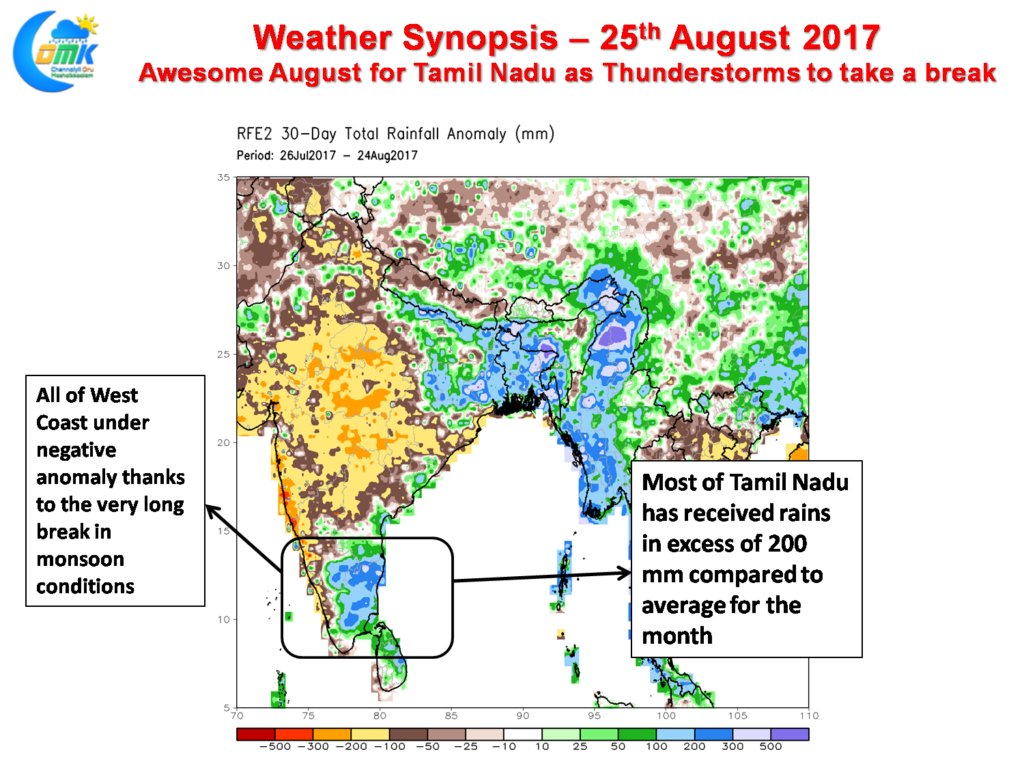
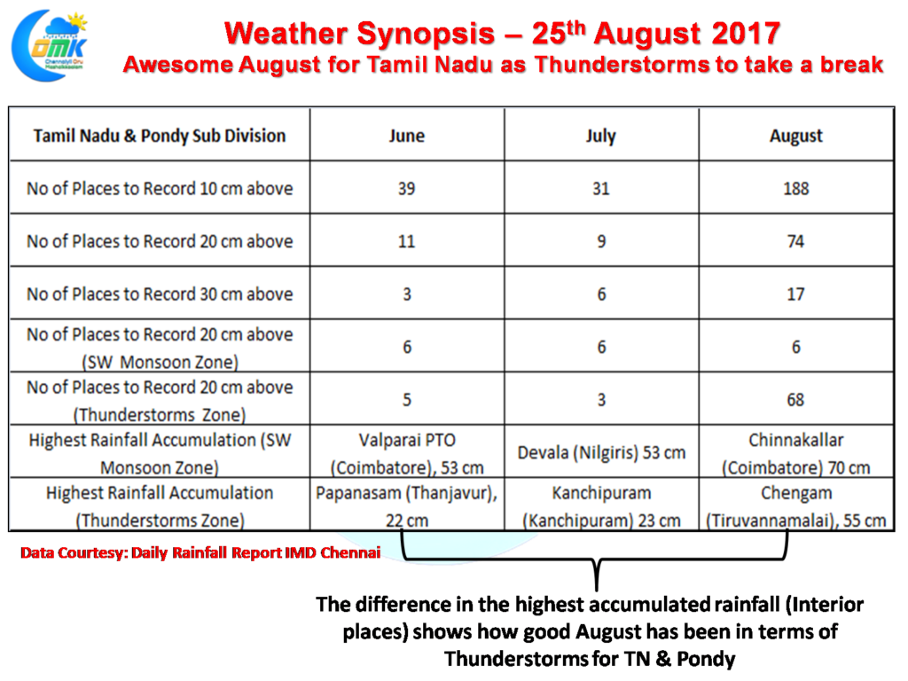
If one were to look at the Precipitation Anomaly charts its quiet visible in terms of the impact thunderstorms have had on the rainfall pattern for the month of August. Similarly if one were to look at the Daily Rainfall report of IMD Chennai the story is similar.
During the months of June & July when the Monsoon was slightly active one can see the list of places that accumulated at least 20 cms for the months dominated by places from the Core Southwest Monsoon Zone, namely the ghats of Nilgiris, Coimbatore, Theni, Tirunelveli & Kanyakumari district. The story in August though is completely different with the list dominated by the interior places. Overall 188 places recorded at least 10 cms for the month making it almost like a Northeast Monsoon season than SW Monsoon when most text books say Tamil Nadu is a rain shadow region
Powered by WPeMatico


