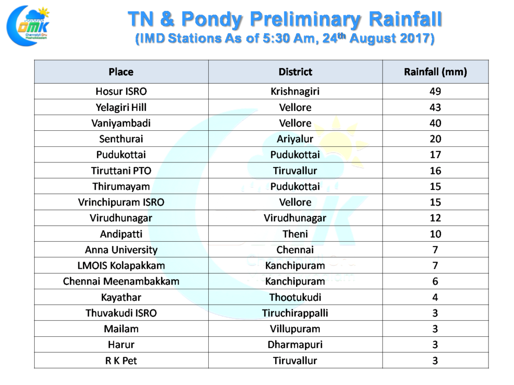
Yesterday saw many interior pats of Peninsular India record good rains in particular around Northwest Tamil Nadu, South Interior Karnataka and adjoining parts of South Andhra Pradesh. Parts of Bengaluru recorded a spell of moderate to heavy thunderstorms last evening creating localized water logging in a few areas in particular around South Bengaluru. Parts of Chennai recorded evening thunderstorms induced by coastal convergence with the southern parts of the city enjoying moderate rains in a few areas.
The interior parts of Tamil Nadu got benefited from the storms that moved from Bengaluru on its Eastward journey with the IMD weather stations at Hosur, Vaniyambadi & Yelagiri recording good rains during the late night. While the thunderstorms passed on their way towards the coast parts of Tiruvannamalai district also got some rains with places around Polur, Chetpet getting moderate showers around mid night.
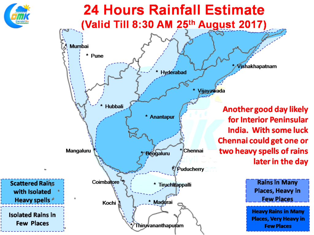
Thanks to the Upper Air Cyclonic Circulation off the coast of Andhra Pradesh it is likely to be another active day of thunderstorms for interior areas of Peninsular India. South Interior Karnataka, Rayalaseema & parts of Interior Tamil Nadu adjoining these two states are once again ideally placed for the evening thunderstorms.
While yesterday’s rains will certainly add well to the Cauvery catchment area upstream of Hogenekal, today is also likely to be another good day for the catchment areas with the districts of Ramanagaram, Kanakapura also in line to get some moderate to heavy thunderstorms.
North Coastal Tamil Nadu around Chennai could possibly get benefited from evening thunderstorms today as well with some streamlined winds showing up to the West of Chennai. With a little luck possibly Chennai & surrounding areas could get a spell or two of heavy rains.
Powered by WPeMatico


