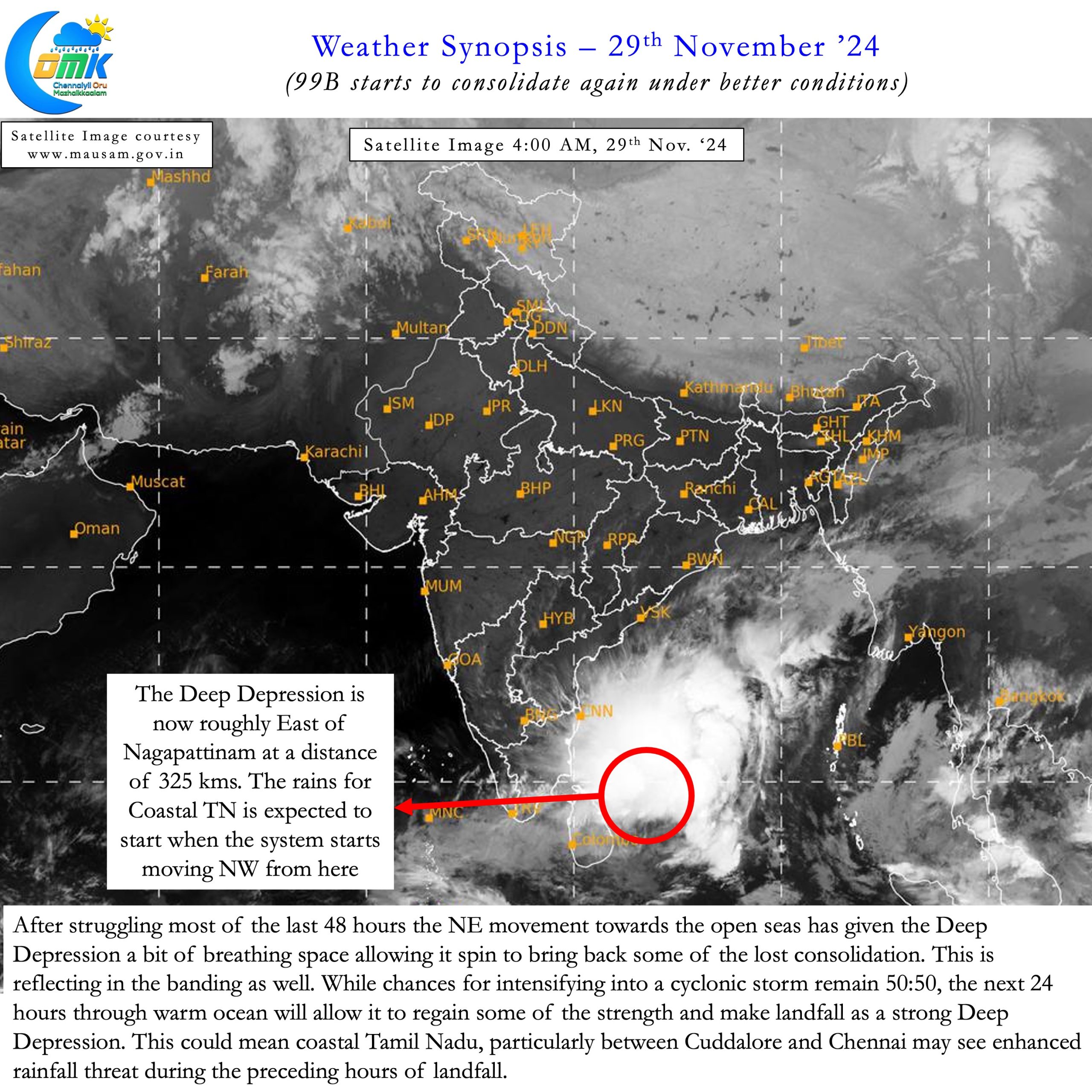
After an eventful 48 hours we are all set for another nerve wracking 48 hours for Coastal Tamil Nadu. Testing the patience of not only weather bloggers but common public as well 99B, Deep Depression, has proved to be tough cookie. Spending nearly 24 hours off the coast of Sri Lanka under unfavourable conditions it has now moved NE towards the open seas. This NE movement has now brought 99B roughly east of Nagapattinam latitude.
Initially expected to reach Nagai latitude on 28th morning it has now reached roughly 24 hours later. The stall near Sri Lanka meant coastal Delta escaped from a potential deluge. A much needed respite considering unlike North TN Delta has been seeing very good rains since mid November. While this delay worked towards helping with lesser rains for delta it could possibly work the other way for North TN. The near stationary movement ESE of originally anticipated zone has now brought landfall closer to Pondicherry.
This shift of landfall zone to the South from the original estimates mean the heaviest rainfall zone now falls north of Pondicherry. 99B is a perfect example of how minute changes in events could bring about drastically different outcomes to various places. Additionally the now converging estimates of models on further westward movement of the deep depression means good news for interior areas of North TN. This could bring some much needed rains to not only these regions but also the catchment ares of Chennai lakes.


The deep depression has been making Northward movement for the past 6 to 9 hours and is expected to take NW turn towards Coastal TN. The point at which the NW turn happens will start the rainfall event for coastal areas fo Tamil Nadu. Till then we may have to wait and watch even though there is very high convergence among models about an extreme rainfall event unloading in the next 48 hours. In what could be a worry the warm ocean and relaxing wind shear now gives 99B a window of intensification.
This could potentially push the Deep Depression into possible Cyclonic Storm level which needs to be kept a tab on. Irrespective of whether 99B intensifies into a Cyclone or not the next 24 hours is likely to be favourable for enhancing the rainfall potential beyond what models expect in case things go according to script. While we will refrain from giving rainfall quantum as committed in our post yesterday we would advice all between Chennai and Pondichery to be on vigil for a widespread very heavy to extremely heavy rainfall event.
Please note rains for Coastal TN including Chennai may start only after the NW movement of 99B until then we may see on and off spells. As the deep depression starts moving NW we will start seeing an increase in intensity of the spells and the rains may start becoming continuous. The key take aways are given below.
- Currently Deep Depression is about 325 kms East of Nagapattinam and is expected northward for the next few hours.
- The Deep Depression under better conditions has started to consolidate once again. Potentially there is a 50:50 chance it could intensity into a cyclonic storm before landfall. Nevertheless as things stand landfall is likely to be as a strong deep depression.
- Most models expect landfall to be around Pondicherrythough there is some divergence on the time line with some estimating tomorrow morning and some pushing it much later to Sunday. There is a good chance landfall may happen later tomorrow evening / night
- The heaviest rainfall zone is likely to be north of landfallpoint so the stretch between Chennai and Pondicherry may bear the brunt of heaviest rains from the precedinghours of landfall
- Rainfall is likely to start when the Deep Depression starts moving NW as the convection gets circulated over the coast. This is likely to happen from later today afternoon / evening
- There is a very high chance the upcoming 24 hours may provide a window of consolidation for the Deep Depression to bring more rainfall than model estimated rainfall quantum if the movement towards coastal TN is slower than estimates.
- Interior areas of TN, South Karnataka and Rayalaseema may see rains as the circulation moves further west after landfall.

