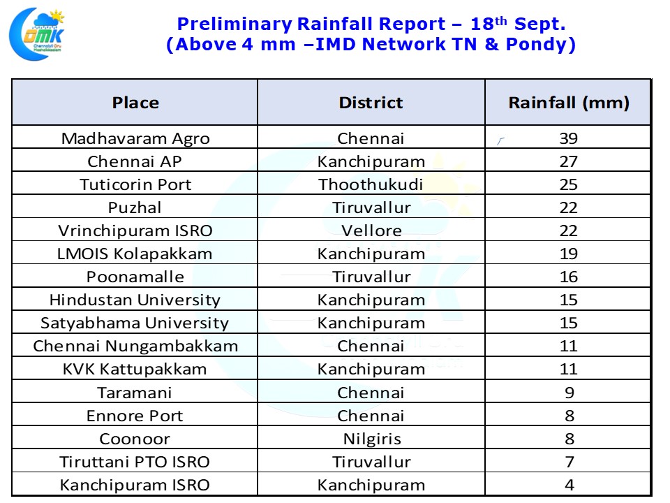
When it Rains in Chennai it does indeed pours. Like the MTC buses that don’t seem to come for long time & then suddenly come in a bunch, for 2nd straight day, most parts of Chennai got moderate rains after midnight. While the city areas around Nungambakkam / Anna Nagar possibly missed out on the heavier spells as places to the North & South of the core city enjoyed good rains.
Madhavaram Agro recorded 39 mm rains till today morning 5:30 AM as light drizzle continued in parts of Chennai as this post was being made. A look at the rainfall numbers confirm how unlike the past few days yesterday the bulk of the rains happened around the extreme North TN areas close to Chennai.
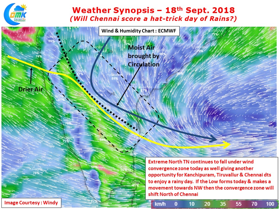
Models indicate not much of rains around Chennai with bulk of the rainfall falling off the coast in the sea. But weather models also indicate a zone of convergence continue to persist over Extreme North TN & adjoining parts of South Andhra Pradesh. If the wind pattern pans out as estimated by the models in terms of convergence zone it could mean a fair chance of 3rd day of thunderstorms for places like Chennai. The Low Pressure is expected to form today and if it moves slightly in a NW direction as expected by models then the angle of winds will change and possibly the convergence zone and associated rainfall will shift North of Chennai.
But looking at the current state of circulation we believe there is a good probability of Chennai Rains scoring a hat-trick


