
While all of Tamil Nadu maintains a tense wait for NEM onset nature churns things at its own pace without any show of emotions. With 2 / 3 false alarms already seen with regard to potential Northeast Monsoon onset the key question remains is whether will Northeast Monsoon check in at the next available opportunity.
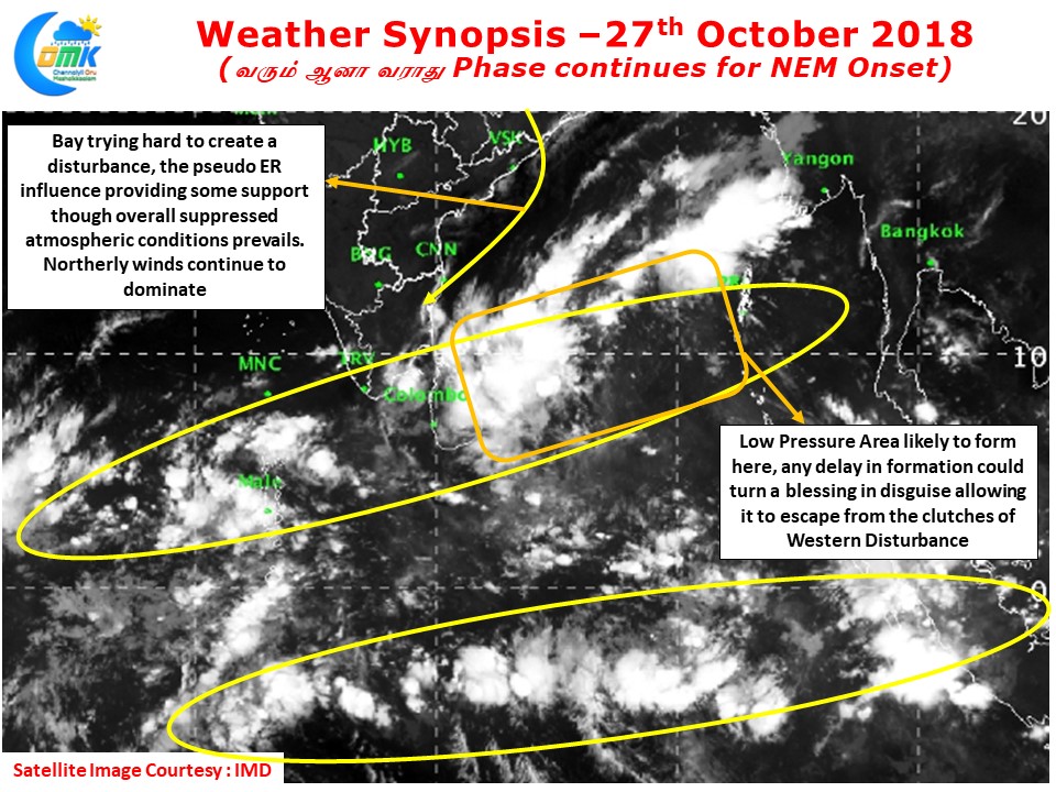
As mentioned in our post yesterday broad circulations on either side of the equator continue to persist under the influence of Pseudo Equatorial Rossby Wave conditions. The broad circulation over Bay is making it difficult for any consolidation. Additionally the strong Northerlies bringing dry air has been holding firm over most of the Indian Sub Continent making it difficult for atmospheric conditions to improve.
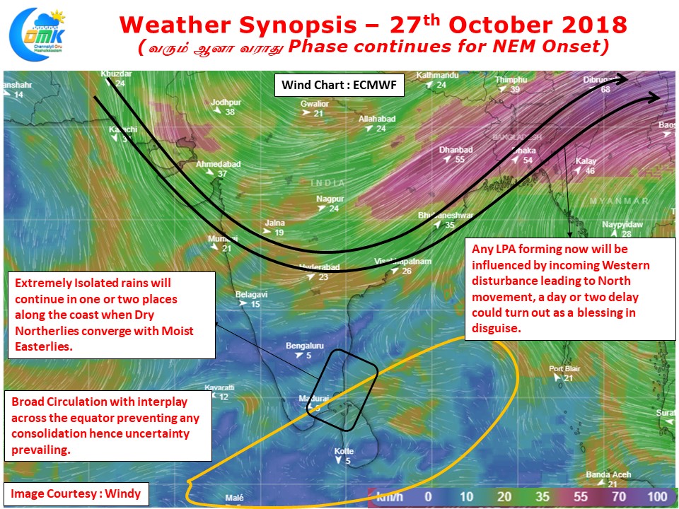
While models are estimating a Low Pressure Area to form around the Southwest Bay the worry is what influence the incoming Western Disturbance could play. Models indicate a strong dip in the Western disturbance reaching up to 14 N latitude which will push any tropical disturbance forming in Bay towards Northern latitudes.
In a way the broad circulations and associated inability for a consolidation by the disturbance could be a boon allowing the LPA to escape from the WD influence and possibly trigger an earlier than expected Onset. But there is a lot of ifs and buts with many things needing to fall in place. The overall chaotic atmosphere has resulted in inconsistent model outputs, this is possibly the biggest reason for the many false alarms so far about the Monsoon Onset.